Połomia geodata
Połomia (Silesia) is a populated place; located in Poland in Europe/Warsaw (GMT+2) time zone. With population of 2,497 people, there are 1255 cities with bigger population in this country. Compared to other cities in Poland, 83% of cities are located further ↑North; 67.4% of cities are located further →East and 74.6% of cities have lower elevation than Połomia. Note1


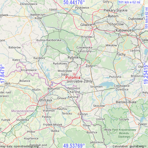
Połomia GPS coordinates[2]
49° 59' 30.66" North, 18° 33' 3.672" East
| Map corner | latitude | longitude |
|---|---|---|
| Upper-left | 50.44176°, | 17.8479° |
| Center: | 49.99185°, | 18.55102° |
| Lower-right: | 49.53769°, | 19.25415° |
| Map W x H: | 100.5×100.5 km | = 62.4×62.4mi |
| max Lat: | 54.83135° ⇑83% North |
| Połomia: | 49.99185° |
| min Lat: | ⇓17% South 49.21328° |
| min Long | Połomia | max Long |
| 14.20249° | 18.55102° | 24.03723° |
| W 32.6%⇐ | ⇒67.4% E |
Elevation
Elevation of Połomia is 245 m = 804 ft, and this is 53.6 m = 176 ft above average elevation for this country.
| Max E: |
974 m = 3196 ft | 25.4% |
| Połomia | 245 m 804 ft | |
| Avg. | 191.4 m = 628 ft | |
Min E: |
-3 m = -10 ft | 74.6% |
See also: Poland elevation on elevation.city.
Geographical zone
Połomia is located in North temperate zone (between Tropic of Cancer and the Arctic Circle). Distance of this North polar circle is 1842.6 km =1144.9 mi to North.| Distance of | km | miles | from Połomia |
|---|---|---|---|
| North Pole | 4448.5 | 2764.2 | to North |
| Arctic Circle | 1842.6 | 1144.9 | to North |
| Tropic Cancer | 2952.7 | 1834.7 | to South |
| Equator | 5558.6 | 3454 | to South |


Nearby cities:
15 places around Połomia: (largest is in red/bold)
• Godów
9.1 km =5.7 mi,  214°
214°
• Gogołowa
2.9 km =1.8 mi,  101°
101°
• Gołkowice
9 km =5.6 mi,  196°
196°
• Jankowice Rybnickie
5.9 km =3.7 mi,  357°
357°
• Jastrzębie Zdrój
4.4 km =2.7 mi,  157°
157°
• Krzyżowice
8.7 km =5.4 mi,  94°
94°
• Markłowice
3.5 km =2.2 mi,  322°
322°
• Mszana
3 km =1.9 mi, 213°
• Niedobczyce
9.1 km =5.7 mi,  334°
334°
• Radlin
8.4 km =5.2 mi, 320°
• Skrzyszów
6.5 km =4 mi,  222°
222°
• Turza Śląska
8.4 km =5.2 mi,  254°
254°
• Wodzisław Śląski
5.8 km =3.6 mi,  283°
283°
• Świerklany Dolne
3.5 km =2.2 mi,  32°
32°
• Świerklany Górne
4.9 km =3 mi,  35°
35°
Sources, notices
• [Note1] Compared only with cities in Poland existing in our database
• [Src1] Map data: © OpenStreetMap contributors (CC-BY-SA)
• [Src2] Other city data from geonames.org with taken over terms of usage.
• [Src3] Geographical zone / Annual Mean Temperature by Robert A. Rohde @ Wikipedia
