Lipno geodata
Lipno (Kujawsko-Pomorskie) is a seat of a third-order administrative division; located in Poland in Europe/Warsaw (GMT+2) time zone. With population of 14,821 people, there are 337 cities with bigger population in this country. Compared to other cities in Poland, 81.5% of cities are located further ↓South; 56.6% of cities are located further →East and 84.6% of cities have higher elevation than Lipno. Note1


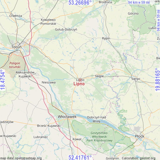
Lipno GPS coordinates[2]
52° 50' 39.696" North, 19° 10' 42.672" East
| Map corner | latitude | longitude |
|---|---|---|
| Upper-left | 53.26696°, | 18.4754° |
| Center: | 52.84436°, | 19.17852° |
| Lower-right: | 52.41761°, | 19.88165° |
| Map W x H: | 94.4×94.4 km | = 58.7×58.7mi |
| max Lat: | 54.83135° ⇑18.5% North |
| Lipno: | 52.84436° |
| min Lat: | ⇓81.5% South 49.21328° |
| min Long | Lipno | max Long |
| 14.20249° | 19.17852° | 24.03723° |
| W 43.4%⇐ | ⇒56.6% E |
Elevation
Elevation of Lipno is 90 m = 295 ft, and this is 101.4 m = 333 ft below average elevation for this country.
| Max E: |
974 m = 3196 ft | 84.6% |
| Avg. | 191.4 m = 628 ft | |
| Lipno | 90 m = 295 ft | |
Min E: |
-3 m = -10 ft | 15.4% |
See also: Poland elevation on elevation.city.
Geographical zone
Lipno is located in North temperate zone (between Tropic of Cancer and the Arctic Circle). Distance of this North polar circle is 1525.4 km =947.8 mi to North.| Distance of | km | miles | from Lipno |
|---|---|---|---|
| North Pole | 4131.3 | 2567.1 | to North |
| Arctic Circle | 1525.4 | 947.8 | to North |
| Tropic Cancer | 3269.8 | 2031.8 | to South |
| Equator | 5875.7 | 3651 | to South |


Nearby cities:
15 places around Lipno: (largest is in red/bold)
• Bobrowniki
16.3 km =10.1 mi,  244°
244°
• Chrostkowo
12.1 km =7.5 mi,  24°
24°
• Czernikowo
19.8 km =12.3 mi,  305°
305°
• Fabianki
14.7 km =9.1 mi,  198°
198°
• Kikół
8.3 km =5.2 mi,  331°
331°
• Lubanie
20.5 km =12.7 mi, 238°
• Lubin
11.3 km =7 mi,  335°
335°
• Nieszawa
18.8 km =11.7 mi,  266°
266°
• Rogowo
20.2 km =12.6 mi,  43°
43°
• Skępe
12.2 km =7.6 mi,  77°
77°
• Waganiec
20.9 km =13 mi,  256°
256°
• Wielgie
12.9 km =8 mi,  153°
153°
• Wielgie
18.3 km =11.4 mi, 343°
• Witkowo
9.4 km =5.8 mi,  179°
179°
• Zbójno
18.3 km =11.4 mi,  355°
355°
Sources, notices
• [Note1] Compared only with cities in Poland existing in our database
• [Src1] Map data: © OpenStreetMap contributors (CC-BY-SA)
• [Src2] Other city data from geonames.org with taken over terms of usage.
• [Src3] Geographical zone / Annual Mean Temperature by Robert A. Rohde @ Wikipedia
