Kleczew geodata
Kleczew (Greater Poland) is a seat of a third-order administrative division; located in Poland in Europe/Warsaw (GMT+2) time zone. With population of 4,217 people, there are 776 cities with bigger population in this country. Compared to other cities in Poland, 74.2% of cities are located further ↓South; 72.9% of cities are located further →East and 81.8% of cities have higher elevation than Kleczew. Note1


Kleczew GPS coordinates[2]
52° 22' 14.052" North, 18° 10' 37.704" East
| Map corner | latitude | longitude |
|---|---|---|
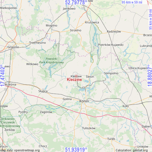
| Upper-left | 52.79778°, | 17.47402° |
| Center: | 52.37057°, | 18.17714° |
| Lower-right: | 51.93919°, | 18.88027° |
| Map W x H: | 95.5×95.5 km | = 59.3×59.3mi |
| max Lat: | 54.83135° ⇑25.8% North |
| Kleczew: | 52.37057° |
| min Lat: | ⇓74.2% South 49.21328° |
| min Long | Kleczew | max Long |
| 14.20249° | 18.17714° | 24.03723° |
| W 27.1%⇐ | ⇒72.9% E |
Elevation
Elevation of Kleczew is 96 m = 315 ft, and this is 95.4 m = 313 ft below average elevation for this country.
| Max E: |
974 m = 3196 ft | 81.8% |
| Avg. | 191.4 m = 628 ft | |
| Kleczew | 96 m = 315 ft | |
Min E: |
-3 m = -10 ft | 18.2% |
See also: Poland elevation on elevation.city.
Geographical zone
Kleczew is located in North temperate zone (between Tropic of Cancer and the Arctic Circle). Distance of this North polar circle is 1578.1 km =980.6 mi to North.| Distance of | km | miles | from Kleczew |
|---|---|---|---|
| North Pole | 4184 | 2599.8 | to North |
| Arctic Circle | 1578.1 | 980.6 | to North |
| Tropic Cancer | 3217.1 | 1999 | to South |
| Equator | 5823.1 | 3618.3 | to South |


Nearby cities:
15 places around Kleczew: (largest is in red/bold)
• Golina
15.3 km =9.5 mi,  202°
202°
• Jeziora Wielkie
18.8 km =11.7 mi,  19°
19°
• Kazimierz Biskupi
6.7 km =4.2 mi,  186°
186°
• Konin
17.1 km =10.6 mi,  162°
162°
• Kramsk
20.5 km =12.7 mi,  125°
125°
• Licheń Stary
13.7 km =8.5 mi,  118°
118°
• Orchowo
18.9 km =11.7 mi,  324°
324°
• Ostrowite
9.1 km =5.7 mi,  278°
278°
• Police
19.9 km =12.4 mi,  91°
91°
• Powidz
18.1 km =11.2 mi,  285°
285°
• Skulsk
16.2 km =10.1 mi,  40°
40°
• Stare Miasto
21.4 km =13.3 mi,  173°
173°
• Wilczogóra
11.5 km =7.1 mi,  356°
356°
• Wilczyn
13.1 km =8.1 mi, 355°
• Ślesin
8.8 km =5.5 mi, 90°
Sources, notices
• [Note1] Compared only with cities in Poland existing in our database
• [Src1] Map data: © OpenStreetMap contributors (CC-BY-SA)
• [Src2] Other city data from geonames.org with taken over terms of usage.
• [Src3] Geographical zone / Annual Mean Temperature by Robert A. Rohde @ Wikipedia
