Jabłonka geodata
Jabłonka (Lesser Poland) is a seat of a third-order administrative division; located in Poland in Europe/Warsaw (GMT+2) time zone. With population of 4,767 people, there are 707 cities with bigger population in this country. Compared to other cities in Poland, 98.5% of cities are located further ↑North; 52.6% of cities are located further ←West and 98.9% of cities have lower elevation than Jabłonka. Note1


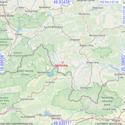
Jabłonka GPS coordinates[2]
49° 28' 46.848" North, 19° 41' 37.32" East
| Map corner | latitude | longitude |
|---|---|---|
| Upper-left | 49.93438°, | 18.99058° |
| Center: | 49.47968°, | 19.6937° |
| Lower-right: | 49.02071°, | 20.39683° |
| Map W x H: | 101.6×101.6 km | = 63.1×63.1mi |
| max Lat: | 54.83135° ⇑98.5% North |
| Jabłonka: | 49.47968° |
| min Lat: | ⇓1.5% South 49.21328° |
| min Long | Jabłonka | max Long |
| 14.20249° | 19.6937° | 24.03723° |
| W 52.6%⇐ | ⇒47.4% E |
Elevation
Elevation of Jabłonka is 617 m = 2024 ft, and this is 425.6 m = 1396 ft above average elevation for this country.
| Max E: |
974 m = 3196 ft | 1.1% |
| Jabłonka | 617 m 2024 ft | |
| Avg. | 191.4 m = 628 ft | |
Min E: |
-3 m = -10 ft | 98.9% |
See also: Poland elevation on elevation.city.
Geographical zone
Jabłonka is located in North temperate zone (between Tropic of Cancer and the Arctic Circle). Distance of this North polar circle is 1899.5 km =1180.3 mi to North.| Distance of | km | miles | from Jabłonka |
|---|---|---|---|
| North Pole | 4505.4 | 2799.5 | to North |
| Arctic Circle | 1899.5 | 1180.3 | to North |
| Tropic Cancer | 2895.7 | 1799.3 | to South |
| Equator | 5501.6 | 3418.5 | to South |


Nearby cities:
15 places around Jabłonka: (largest is in red/bold)
• Chyżne
6.1 km =3.8 mi,  196°
196°
• Czarny Dunajec
12.4 km =7.7 mi,  112°
112°
• Harkabuz
12.1 km =7.5 mi,  57°
57°
• Lipnica Mała
5.8 km =3.6 mi,  312°
312°
• Lipnica Wielka
4 km =2.5 mi,  261°
261°
• Odrowąż
11.7 km =7.3 mi,  80°
80°
• Orawka
4.4 km =2.7 mi,  29°
29°
• Piekielnik
5.4 km =3.4 mi,  93°
93°
• Pieniążkowice
13.6 km =8.5 mi, 81°
• Podsarnie
10.7 km =6.6 mi,  40°
40°
• Podwilk
8.2 km =5.1 mi,  23°
23°
• Sidzina
12.5 km =7.8 mi,  5°
5°
• Załuczne
9.1 km =5.7 mi, 81°
• Zubrzyca Dolna
5.4 km =3.4 mi,  344°
344°
• Zubrzyca Górna
9.7 km =6 mi, 340°
Sources, notices
• [Note1] Compared only with cities in Poland existing in our database
• [Src1] Map data: © OpenStreetMap contributors (CC-BY-SA)
• [Src2] Other city data from geonames.org with taken over terms of usage.
• [Src3] Geographical zone / Annual Mean Temperature by Robert A. Rohde @ Wikipedia
