Czarny Dunajec geodata
Czarny Dunajec (Lesser Poland) is a seat of a third-order administrative division; located in Poland in Europe/Warsaw (GMT+2) time zone. With population of 3,594 people, there are 892 cities with bigger population in this country. Compared to other cities in Poland, 99.3% of cities are located further ↑North; 56% of cities are located further ←West and 99.6% of cities have lower elevation than Czarny Dunajec. Note1
Administrative division(s):
- Level 1: Lesser Poland
- Level 2: Powiat nowotarski
- Level 3: Czarny Dunajec


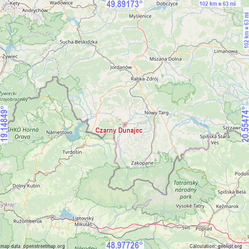
Czarny Dunajec GPS coordinates[2]
49° 26' 11.868" North, 19° 51' 5.796" East
| Map corner | latitude | longitude |
|---|---|---|
| Upper-left | 49.89173°, | 19.14849° |
| Center: | 49.43663°, | 19.85161° |
| Lower-right: | 48.97726°, | 20.55474° |
| Map W x H: | 101.7×101.7 km | = 63.2×63.2mi |
| max Lat: | 54.83135° ⇑99.3% North |
| Czarny Dunajec: | 49.43663° |
| min Lat: | ⇓0.7% South 49.21328° |
| min Long | Czarny Dunajec | max Long |
| 14.20249° | 19.85161° | 24.03723° |
| W 56%⇐ | ⇒44% E |
Elevation
Elevation of Czarny Dunajec is 678 m = 2224 ft, and this is 486.6 m = 1596 ft above average elevation for this country.
| Max E: |
974 m = 3196 ft | 0.40000000000001% |
| Czarny Dunajec | 678 m 2224 ft | |
| Avg. | 191.4 m = 628 ft | |
Min E: |
-3 m = -10 ft | 99.6% |
See also: Poland elevation on elevation.city.
Geographical zone
Czarny Dunajec is located in North temperate zone (between Tropic of Cancer and the Arctic Circle). Distance of this North polar circle is 1904.3 km =1183.3 mi to North.| Distance of | km | miles | from Czarny Dunajec |
|---|---|---|---|
| North Pole | 4510.2 | 2802.5 | to North |
| Arctic Circle | 1904.3 | 1183.3 | to North |
| Tropic Cancer | 2890.9 | 1796.3 | to South |
| Equator | 5496.8 | 3415.6 | to South |


Nearby cities:
15 places around Czarny Dunajec: (largest is in red/bold)
• Harkabuz
11.4 km =7.1 mi,  354°
354°
• Jabłonka
12.4 km =7.7 mi,  292°
292°
• Krauszów
8.7 km =5.4 mi,  60°
60°
• Lasek
12.3 km =7.6 mi,  49°
49°
• Ludźmierz
10 km =6.2 mi,  70°
70°
• Odrowąż
6.7 km =4.2 mi,  1°
1°
• Orawka
12.6 km =7.8 mi,  313°
313°
• Piekielnik
7.5 km =4.7 mi, 306°
• Pieniążkowice
7.1 km =4.4 mi,  16°
16°
• Pyzówka
10.7 km =6.6 mi,  35°
35°
• Sieniawa
12.8 km =8 mi,  26°
26°
• Szaflary
12.7 km =7.9 mi,  95°
95°
• Trute
10.4 km =6.5 mi, 53°
• Wróblówka
3.3 km =2.1 mi, 54°
• Załuczne
6.7 km =4.2 mi,  338°
338°
Sources, notices
• [Note1] Compared only with cities in Poland existing in our database
• [Src1] Map data: © OpenStreetMap contributors (CC-BY-SA)
• [Src2] Other city data from geonames.org with taken over terms of usage.
• [Src3] Geographical zone / Annual Mean Temperature by Robert A. Rohde @ Wikipedia
