Dobra geodata
Dobra (West Pomerania) is a seat of a third-order administrative division; located in Poland in Europe/Warsaw (GMT+2) time zone. With population of 950 people, there are 2592 cities with bigger population in this country. Compared to other cities in Poland, 89.4% of cities are located further ↓South; 99.9% of cities are located further →East and 97.2% of cities have higher elevation than Dobra. Note1
Administrative division(s):
- Level 1: West Pomerania
- Level 2: Powiat policki
- Level 3: Dobra (Szczecińska)


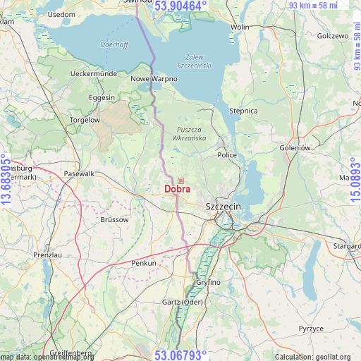
Dobra GPS coordinates[2]
53° 29' 18.06" North, 14° 23' 10.212" East
| Map corner | latitude | longitude |
|---|---|---|
| Upper-left | 53.90464°, | 13.68305° |
| Center: | 53.48835°, | 14.38617° |
| Lower-right: | 53.06793°, | 15.0893° |
| Map W x H: | 93×93 km | = 57.8×57.8mi |
| max Lat: | 54.83135° ⇑10.6% North |
| Dobra: | 53.48835° |
| min Lat: | ⇓89.4% South 49.21328° |
| min Long | Dobra | max Long |
| 14.20249° | 14.38617° | 24.03723° |
| W 0.1%⇐ | ⇒99.9% E |
Elevation
Elevation of Dobra is 20 m = 66 ft, and this is 171.4 m = 562 ft below average elevation for this country.
| Max E: |
974 m = 3196 ft | 97.2% |
| Avg. | 191.4 m = 628 ft | |
| Dobra | 20 m = 66 ft | |
Min E: |
-3 m = -10 ft | 2.8% |
See also: Poland elevation on elevation.city.
Geographical zone
Dobra is located in North temperate zone (between Tropic of Cancer and the Arctic Circle). Distance of this North polar circle is 1453.8 km =903.3 mi to North.| Distance of | km | miles | from Dobra |
|---|---|---|---|
| North Pole | 4059.7 | 2522.6 | to North |
| Arctic Circle | 1453.8 | 903.3 | to North |
| Tropic Cancer | 3341.4 | 2076.2 | to South |
| Equator | 5947.3 | 3695.5 | to South |


Nearby cities:
15 places around Dobra: (largest is in red/bold)
• Bielice
39.2 km =24.4 mi,  144°
144°
• Goleniów
30.4 km =18.9 mi,  73°
73°
• Gryfino
27.1 km =16.8 mi,  165°
165°
• Kobylanka
35.9 km =22.3 mi,  116°
116°
• Kołbaskowo
17.2 km =10.7 mi, 168°
• Morzyczyn
38.4 km =23.9 mi,  113°
113°
• Mosty
38.3 km =23.8 mi,  80°
80°
• Nowe Warpno
26.8 km =16.7 mi,  346°
346°
• Police
14.2 km =8.8 mi,  59°
59°
• Przecław
13.9 km =8.6 mi,  155°
155°
• Przybiernów
39.9 km =24.8 mi,  41°
41°
• Stare Czarnowo
35 km =21.7 mi,  131°
131°
• Stepnica
24.1 km =15 mi, 41°
• Szczecin
12.9 km =8 mi, 120°
• Widuchowa
40.2 km =25 mi,  179°
179°
Sources, notices
• [Note1] Compared only with cities in Poland existing in our database
• [Src1] Map data: © OpenStreetMap contributors (CC-BY-SA)
• [Src2] Other city data from geonames.org with taken over terms of usage.
• [Src3] Geographical zone / Annual Mean Temperature by Robert A. Rohde @ Wikipedia
