Dębowa Łąka geodata
Dębowa Łąka (Kujawsko-Pomorskie) is a seat of a third-order administrative division; located in Poland in Europe/Warsaw (GMT+2) time zone. With population of 750 people, there are 2953 cities with bigger population in this country. Compared to other cities in Poland, 86.9% of cities are located further ↓South; 58.4% of cities are located further →East and 82.7% of cities have higher elevation than Dębowa Łąka. Note1
Administrative division(s):
- Level 1: Kujawsko-Pomorskie
- Level 2: Powiat wąbrzeski
- Level 3: Dębowa Łąka


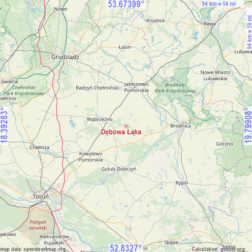
Dębowa Łąka GPS coordinates[2]
53° 15' 19.476" North, 19° 5' 45.42" East
| Map corner | latitude | longitude |
|---|---|---|
| Upper-left | 53.67399°, | 18.39283° |
| Center: | 53.25541°, | 19.09595° |
| Lower-right: | 52.8327°, | 19.79908° |
| Map W x H: | 93.5×93.5 km | = 58.1×58.1mi |
| max Lat: | 54.83135° ⇑13.1% North |
| Dębowa Łąka: | 53.25541° |
| min Lat: | ⇓86.9% South 49.21328° |
| min Long | Dębowa Łąka | max Long |
| 14.20249° | 19.09595° | 24.03723° |
| W 41.6%⇐ | ⇒58.4% E |
Elevation
Elevation of Dębowa Łąka is 94 m = 308 ft, and this is 97.4 m = 320 ft below average elevation for this country.
| Max E: |
974 m = 3196 ft | 82.7% |
| Avg. | 191.4 m = 628 ft | |
| Dębowa Łąka | 94 m = 308 ft | |
Min E: |
-3 m = -10 ft | 17.3% |
See also: Poland elevation on elevation.city.
Geographical zone
Dębowa Łąka is located in North temperate zone (between Tropic of Cancer and the Arctic Circle). Distance of this North polar circle is 1479.7 km =919.4 mi to North.| Distance of | km | miles | from Dębowa Łąka |
|---|---|---|---|
| North Pole | 4085.6 | 2538.7 | to North |
| Arctic Circle | 1479.7 | 919.4 | to North |
| Tropic Cancer | 3315.5 | 2060.2 | to South |
| Equator | 5921.4 | 3679.4 | to South |


Nearby cities:
15 places around Dębowa Łąka: (largest is in red/bold)
• Bobrowo
12.1 km =7.5 mi,  73°
73°
• Brodnica
20 km =12.4 mi,  88°
88°
• Golub-Dobrzyń
16.3 km =10.1 mi,  189°
189°
• Jabłonowo Pomorskie
15.6 km =9.7 mi,  14°
14°
• Kowalewo Pomorskie
17.3 km =10.7 mi,  229°
229°
• Książki
8.4 km =5.2 mi,  348°
348°
• Lisewo
12 km =7.5 mi, 188°
• Osiek
21.6 km =13.4 mi,  116°
116°
• Ostrowite
14.6 km =9.1 mi,  210°
210°
• Radomin
19.9 km =12.4 mi,  160°
160°
• Radzyń Chełmiński
17.9 km =11.1 mi,  323°
323°
• Wąbrzeźno
10.2 km =6.3 mi,  285°
285°
• Wąpielsk
17.8 km =11.1 mi,  137°
137°
• Zbiczno
20.5 km =12.7 mi,  64°
64°
• Świecie nad Osą
21 km =13 mi,  1°
1°
Sources, notices
• [Note1] Compared only with cities in Poland existing in our database
• [Src1] Map data: © OpenStreetMap contributors (CC-BY-SA)
• [Src2] Other city data from geonames.org with taken over terms of usage.
• [Src3] Geographical zone / Annual Mean Temperature by Robert A. Rohde @ Wikipedia
