Wąbrzeźno geodata
Wąbrzeźno (Kujawsko-Pomorskie) is a seat of a second-order administrative division; located in Poland in Europe/Warsaw (GMT+2) time zone. With population of 13,911 people, there are 356 cities with bigger population in this country. Compared to other cities in Poland, 87.2% of cities are located further ↓South; 61% of cities are located further →East and 77.2% of cities have higher elevation than Wąbrzeźno. Note1
Administrative division(s):
- Level 1: Kujawsko-Pomorskie
- Level 2: Powiat wąbrzeski
- Level 3: Wąbrzeźno


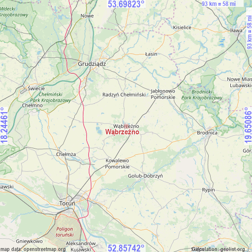
Wąbrzeźno GPS coordinates[2]
53° 16' 47.604" North, 18° 56' 51.828" East
| Map corner | latitude | longitude |
|---|---|---|
| Upper-left | 53.69823°, | 18.24461° |
| Center: | 53.27989°, | 18.94773° |
| Lower-right: | 52.85742°, | 19.65086° |
| Map W x H: | 93.5×93.5 km | = 58.1×58.1mi |
| max Lat: | 54.83135° ⇑12.8% North |
| Wąbrzeźno: | 53.27989° |
| min Lat: | ⇓87.2% South 49.21328° |
| min Long | Wąbrzeźno | max Long |
| 14.20249° | 18.94773° | 24.03723° |
| W 39%⇐ | ⇒61% E |
Elevation
Elevation of Wąbrzeźno is 105 m = 344 ft, and this is 86.4 m = 283 ft below average elevation for this country.
| Max E: |
974 m = 3196 ft | 77.2% |
| Avg. | 191.4 m = 628 ft | |
| Wąbrzeźno | 105 m = 344 ft | |
Min E: |
-3 m = -10 ft | 22.8% |
See also: Poland elevation on elevation.city.
Geographical zone
Wąbrzeźno is located in North temperate zone (between Tropic of Cancer and the Arctic Circle). Distance of this North polar circle is 1477 km =917.8 mi to North.| Distance of | km | miles | from Wąbrzeźno |
|---|---|---|---|
| North Pole | 4082.9 | 2537 | to North |
| Arctic Circle | 1477 | 917.8 | to North |
| Tropic Cancer | 3318.2 | 2061.8 | to South |
| Equator | 5924.2 | 3681.1 | to South |


Nearby cities:
15 places around Wąbrzeźno: (largest is in red/bold)
• Bobrowo
21.5 km =13.4 mi,  88°
88°
• Ciechocin
25 km =15.5 mi,  183°
183°
• Dębowa Łąka
10.2 km =6.3 mi,  105°
105°
• Golub-Dobrzyń
20.1 km =12.5 mi,  159°
159°
• Gruta
19.3 km =12 mi,  1°
1°
• Jabłonowo Pomorskie
18.5 km =11.5 mi,  48°
48°
• Kowalewo Pomorskie
14.3 km =8.9 mi,  193°
193°
• Książki
9.9 km =6.2 mi,  55°
55°
• Lisewo
16.6 km =10.3 mi,  150°
150°
• Lisewo
17.4 km =10.8 mi,  275°
275°
• Ostrowite
15.4 km =9.6 mi,  170°
170°
• Płużnica
11.5 km =7.1 mi, 279°
• Radzyń Chełmiński
11.7 km =7.3 mi,  356°
356°
• Skąpe
23.2 km =14.4 mi,  252°
252°
• Świecie nad Osą
20.9 km =13 mi,  29°
29°
Sources, notices
• [Note1] Compared only with cities in Poland existing in our database
• [Src1] Map data: © OpenStreetMap contributors (CC-BY-SA)
• [Src2] Other city data from geonames.org with taken over terms of usage.
• [Src3] Geographical zone / Annual Mean Temperature by Robert A. Rohde @ Wikipedia
