Czarnocin geodata
Czarnocin (Łódź Voivodeship) is a seat of a third-order administrative division; located in Poland in Europe/Warsaw (GMT+2) time zone. With population of 1,300 people, there are 2055 cities with bigger population in this country. Compared to other cities in Poland, 57.6% of cities are located further ↓South; 52.4% of cities are located further ←West and 62.4% of cities have lower elevation than Czarnocin. Note1
Administrative division(s):
- Level 1: Łódź Voivodeship
- Level 2: Powiat piotrkowski
- Level 3: Czarnocin


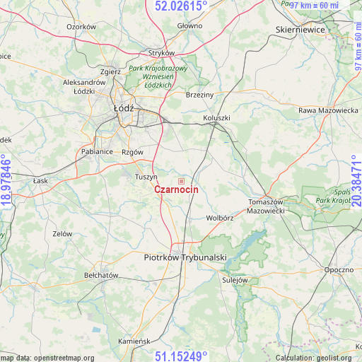
Czarnocin GPS coordinates[2]
51° 35' 29.112" North, 19° 40' 53.688" East
| Map corner | latitude | longitude |
|---|---|---|
| Upper-left | 52.02615°, | 18.97846° |
| Center: | 51.59142°, | 19.68158° |
| Lower-right: | 51.15249°, | 20.38471° |
| Map W x H: | 97.1×97.1 km | = 60.3×60.3mi |
| max Lat: | 54.83135° ⇑42.4% North |
| Czarnocin: | 51.59142° |
| min Lat: | ⇓57.6% South 49.21328° |
| min Long | Czarnocin | max Long |
| 14.20249° | 19.68158° | 24.03723° |
| W 52.4%⇐ | ⇒47.6% E |
Elevation
Elevation of Czarnocin is 207 m = 679 ft, and this is 15.6 m = 51 ft above average elevation for this country.
| Max E: |
974 m = 3196 ft | 37.6% |
| Czarnocin | 207 m 679 ft | |
| Avg. | 191.4 m = 628 ft | |
Min E: |
-3 m = -10 ft | 62.4% |
See also: Poland elevation on elevation.city.
Geographical zone
Czarnocin is located in North temperate zone (between Tropic of Cancer and the Arctic Circle). Distance of this North polar circle is 1664.7 km =1034.4 mi to North.| Distance of | km | miles | from Czarnocin |
|---|---|---|---|
| North Pole | 4270.6 | 2653.6 | to North |
| Arctic Circle | 1664.7 | 1034.4 | to North |
| Tropic Cancer | 3130.5 | 1945.2 | to South |
| Equator | 5736.4 | 3564.4 | to South |


Nearby cities:
15 places around Czarnocin: (largest is in red/bold)
• Andrespol
15.4 km =9.6 mi,  349°
349°
• Brójce
8.4 km =5.2 mi,  344°
344°
• Będków
4.7 km =2.9 mi,  95°
95°
• Gałków Duży
16.4 km =10.2 mi,  10°
10°
• Gałków Mały
15.1 km =9.4 mi, 8°
• Grabica
16.2 km =10.1 mi,  219°
219°
• Moszczenica
10.2 km =6.3 mi,  164°
164°
• Rokiciny
10.6 km =6.6 mi,  51°
51°
• Rokiciny-Kolonia
10.7 km =6.6 mi,  40°
40°
• Rzgów
15.4 km =9.6 mi,  301°
301°
• Starowa Góra
17.6 km =10.9 mi,  309°
309°
• Tuszyn
10.7 km =6.6 mi,  280°
280°
• Ujazd
16.6 km =10.3 mi,  87°
87°
• Wola Rakowa
10.3 km =6.4 mi,  331°
331°
• Wolbórz
14.3 km =8.9 mi,  134°
134°
Sources, notices
• [Note1] Compared only with cities in Poland existing in our database
• [Src1] Map data: © OpenStreetMap contributors (CC-BY-SA)
• [Src2] Other city data from geonames.org with taken over terms of usage.
• [Src3] Geographical zone / Annual Mean Temperature by Robert A. Rohde @ Wikipedia
