Bełsznica geodata
Bełsznica (Silesia) is a populated place; located in Poland in Europe/Warsaw (GMT+2) time zone. With population of 1,095 people, there are 2362 cities with bigger population in this country. Compared to other cities in Poland, 84.1% of cities are located further ↑North; 70.4% of cities are located further →East and 65.9% of cities have lower elevation than Bełsznica. Note1


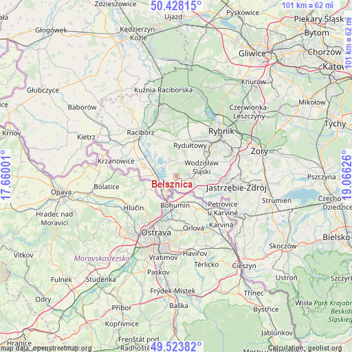
Bełsznica GPS coordinates[2]
49° 58' 41.196" North, 18° 21' 47.268" East
| Map corner | latitude | longitude |
|---|---|---|
| Upper-left | 50.42815°, | 17.66001° |
| Center: | 49.97811°, | 18.36313° |
| Lower-right: | 49.52382°, | 19.06626° |
| Map W x H: | 100.6×100.6 km | = 62.5×62.5mi |
| max Lat: | 54.83135° ⇑84.1% North |
| Bełsznica: | 49.97811° |
| min Lat: | ⇓15.9% South 49.21328° |
| min Long | Bełsznica | max Long |
| 14.20249° | 18.36313° | 24.03723° |
| W 29.6%⇐ | ⇒70.4% E |
Elevation
Elevation of Bełsznica is 216 m = 709 ft, and this is 24.6 m = 81 ft above average elevation for this country.
| Max E: |
974 m = 3196 ft | 34.1% |
| Bełsznica | 216 m 709 ft | |
| Avg. | 191.4 m = 628 ft | |
Min E: |
-3 m = -10 ft | 65.9% |
See also: Poland elevation on elevation.city.
Geographical zone
Bełsznica is located in North temperate zone (between Tropic of Cancer and the Arctic Circle). Distance of this North polar circle is 1844.1 km =1145.9 mi to North.| Distance of | km | miles | from Bełsznica |
|---|---|---|---|
| North Pole | 4450 | 2765.1 | to North |
| Arctic Circle | 1844.1 | 1145.9 | to North |
| Tropic Cancer | 2951.1 | 1833.7 | to South |
| Equator | 5557 | 3453 | to South |


Nearby cities:
15 places around Bełsznica: (largest is in red/bold)
• Chałupki
6.7 km =4.2 mi,  209°
209°
• Czyżowice
3 km =1.9 mi,  75°
75°
• Gorzyce
3.3 km =2.1 mi,  129°
129°
• Gorzyczki
4.3 km =2.7 mi,  138°
138°
• Krzyżanowice
6.8 km =4.2 mi,  274°
274°
• Lubomia
7.9 km =4.9 mi,  330°
330°
• Olza
3.2 km =2 mi, 212°
• Pszów
7.2 km =4.5 mi,  18°
18°
• Rogów
1.7 km =1.1 mi, 328°
• Skrzyszów
9.6 km =6 mi,  109°
109°
• Syrynia
4.8 km =3 mi,  345°
345°
• Turza Śląska
5.4 km =3.4 mi,  96°
96°
• Tworków
9.6 km =6 mi,  288°
288°
• Wodzisław Śląski
8.3 km =5.2 mi,  69°
69°
• Łaziska
7.6 km =4.7 mi, 128°
Sources, notices
• [Note1] Compared only with cities in Poland existing in our database
• [Src1] Map data: © OpenStreetMap contributors (CC-BY-SA)
• [Src2] Other city data from geonames.org with taken over terms of usage.
• [Src3] Geographical zone / Annual Mean Temperature by Robert A. Rohde @ Wikipedia
