Babice geodata
Babice (Lesser Poland) is a seat of a third-order administrative division; located in Poland in Europe/Warsaw (GMT+2) time zone. With population of 1,369 people, there are 2008 cities with bigger population in this country. Compared to other cities in Poland, 79.2% of cities are located further ↑North; 51.9% of cities are located further →East and 78.1% of cities have lower elevation than Babice. Note1


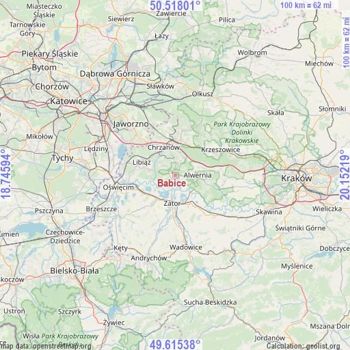
Babice GPS coordinates[2]
50° 4' 7.752" North, 19° 26' 56.616" East
| Map corner | latitude | longitude |
|---|---|---|
| Upper-left | 50.51801°, | 18.74594° |
| Center: | 50.06882°, | 19.44906° |
| Lower-right: | 49.61538°, | 20.15219° |
| Map W x H: | 100.4×100.4 km | = 62.4×62.4mi |
| max Lat: | 54.83135° ⇑79.2% North |
| Babice: | 50.06882° |
| min Lat: | ⇓20.8% South 49.21328° |
| min Long | Babice | max Long |
| 14.20249° | 19.44906° | 24.03723° |
| W 48.1%⇐ | ⇒51.9% E |
Elevation
Elevation of Babice is 258 m = 846 ft, and this is 66.6 m = 219 ft above average elevation for this country.
| Max E: |
974 m = 3196 ft | 21.9% |
| Babice | 258 m 846 ft | |
| Avg. | 191.4 m = 628 ft | |
Min E: |
-3 m = -10 ft | 78.1% |
See also: Poland elevation on elevation.city.
Geographical zone
Babice is located in North temperate zone (between Tropic of Cancer and the Arctic Circle). Distance of this North polar circle is 1834 km =1139.6 mi to North.| Distance of | km | miles | from Babice |
|---|---|---|---|
| North Pole | 4439.9 | 2758.8 | to North |
| Arctic Circle | 1834 | 1139.6 | to North |
| Tropic Cancer | 2961.2 | 1840 | to South |
| Equator | 5567.1 | 3459.2 | to South |


Nearby cities:
15 places around Babice: (largest is in red/bold)
• Alwernia
6.5 km =4 mi,  98°
98°
• Bolęcin
5.9 km =3.7 mi,  22°
22°
• Grojec
8 km =5 mi,  73°
73°
• Jankowice
2.8 km =1.7 mi,  190°
190°
• Kwaczała
3.1 km =1.9 mi, 99°
• Mętków
5.6 km =3.5 mi,  251°
251°
• Okleśna
7.2 km =4.5 mi,  125°
125°
• Olszyny
1.8 km =1.1 mi,  172°
172°
• Piła Kościelecka
7.1 km =4.4 mi,  7°
7°
• Pogorzyce
4.1 km =2.5 mi,  332°
332°
• Płaza
3.6 km =2.2 mi, 17°
• Regulice
5.8 km =3.6 mi, 74°
• Rozkochów
4 km =2.5 mi, 132°
• Zagórze
4.3 km =2.7 mi,  311°
311°
• Żarki
7.1 km =4.4 mi,  282°
282°
Sources, notices
• [Note1] Compared only with cities in Poland existing in our database
• [Src1] Map data: © OpenStreetMap contributors (CC-BY-SA)
• [Src2] Other city data from geonames.org with taken over terms of usage.
• [Src3] Geographical zone / Annual Mean Temperature by Robert A. Rohde @ Wikipedia
