Aleksandrów Kujawski geodata
Aleksandrów Kujawski (Kujawsko-Pomorskie) is a populated place; located in Poland in Europe/Warsaw (GMT+2) time zone. With population of 12,290 people, there are 385 cities with bigger population in this country. Compared to other cities in Poland, 81.9% of cities are located further ↓South; 65.1% of cities are located further →East and 90.6% of cities have higher elevation than Aleksandrów Kujawski. Note1
Administrative division(s):
- Level 1: Kujawsko-Pomorskie
- Level 2: Powiat aleksandrowski
- Level 3: Aleksandrów Kujawski


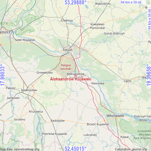
Aleksandrów Kujawski GPS coordinates[2]
52° 52' 35.724" North, 18° 41' 36.42" East
| Map corner | latitude | longitude |
|---|---|---|
| Upper-left | 53.29888°, | 17.99033° |
| Center: | 52.87659°, | 18.69345° |
| Lower-right: | 52.45015°, | 19.39658° |
| Map W x H: | 94.4×94.4 km | = 58.7×58.7mi |
| max Lat: | 54.83135° ⇑18.1% North |
| Aleksandrów Kujawski: | 52.87659° |
| min Lat: | ⇓81.9% South 49.21328° |
| min Long | Aleksandrów Ku | max Long |
| 14.20249° | 18.69345° | 24.03723° |
| W 34.9%⇐ | ⇒65.1% E |
Elevation
Elevation of Aleksandrów Kujawski is 72 m = 236 ft, and this is 119.4 m = 392 ft below average elevation for this country.
| Max E: |
974 m = 3196 ft | 90.6% |
| Avg. | 191.4 m = 628 ft | |
| Aleksandrów Kujawski | 72 m = 236 ft | |
Min E: |
-3 m = -10 ft | 9.4% |
See also: Poland elevation on elevation.city.
Geographical zone
Aleksandrów Kujawski is located in North temperate zone (between Tropic of Cancer and the Arctic Circle). Distance of this North polar circle is 1521.8 km =945.6 mi to North.| Distance of | km | miles | from Aleksandrów Kujawski |
|---|---|---|---|
| North Pole | 4127.7 | 2564.8 | to North |
| Arctic Circle | 1521.8 | 945.6 | to North |
| Tropic Cancer | 3273.4 | 2034 | to South |
| Equator | 5879.3 | 3653.2 | to South |


Nearby cities:
15 places around Aleksandrów Kujawski: (largest is in red/bold)
• Ciechocinek
6.8 km =4.2 mi,  87°
87°
• Czernikowo
18.2 km =11.3 mi,  64°
64°
• Dąbrowa Biskupia
14.8 km =9.2 mi,  222°
222°
• Gniewkowo
19.3 km =12 mi,  275°
275°
• Koneck
10.5 km =6.5 mi,  170°
170°
• Lubicz Dolny
17.6 km =10.9 mi,  11°
11°
• Lubicz Górny
17.5 km =10.9 mi,  17°
17°
• Nieszawa
14.6 km =9.1 mi,  108°
108°
• Obrowo
16.3 km =10.1 mi,  49°
49°
• Osiek
9.4 km =5.8 mi, 54°
• Raciążek
8.4 km =5.2 mi, 105°
• Toruń
16.5 km =10.3 mi,  337°
337°
• Waganiec
14.8 km =9.2 mi,  124°
124°
• Wielka Nieszawka
18.1 km =11.2 mi,  317°
317°
• Zakrzewo
13.7 km =8.5 mi,  197°
197°
Sources, notices
• [Note1] Compared only with cities in Poland existing in our database
• [Src1] Map data: © OpenStreetMap contributors (CC-BY-SA)
• [Src2] Other city data from geonames.org with taken over terms of usage.
• [Src3] Geographical zone / Annual Mean Temperature by Robert A. Rohde @ Wikipedia
