Toruń geodata
Toruń (Kujawsko-Pomorskie) is a populated place; located in Poland in Europe/Warsaw (GMT+2) time zone. With population of 208,717 people, there are 16 cities with bigger population in this country. Compared to other cities in Poland, 83.8% of cities are located further ↓South; 66.7% of cities are located further →East and 94.2% of cities have higher elevation than Toruń. Note1


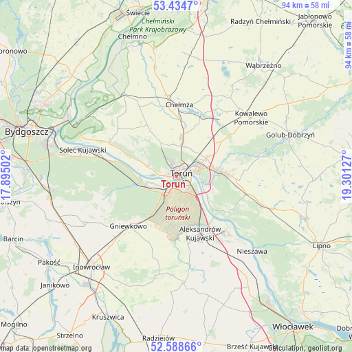
Toruń GPS coordinates[2]
53° 0' 49.5" North, 18° 35' 53.304" East
| Map corner | latitude | longitude |
|---|---|---|
| Upper-left | 53.4347°, | 17.89502° |
| Center: | 53.01375°, | 18.59814° |
| Lower-right: | 52.58866°, | 19.30127° |
| Map W x H: | 94.1×94.1 km | = 58.5×58.5mi |
| max Lat: | 54.83135° ⇑16.2% North |
| Toruń: | 53.01375° |
| min Lat: | ⇓83.8% South 49.21328° |
| min Long | Toruń | max Long |
| 14.20249° | 18.59814° | 24.03723° |
| W 33.3%⇐ | ⇒66.7% E |
Elevation
Elevation of Toruń is 51 m = 167 ft, and this is 140.4 m = 461 ft below average elevation for this country.
| Max E: |
974 m = 3196 ft | 94.2% |
| Avg. | 191.4 m = 628 ft | |
| Toruń | 51 m = 167 ft | |
Min E: |
-3 m = -10 ft | 5.8% |
See also: Toruń elevation on elevation.city.
Geographical zone
Toruń is located in North temperate zone (between Tropic of Cancer and the Arctic Circle). Distance of this North polar circle is 1506.6 km =936.2 mi to North.| Distance of | km | miles | from Toruń |
|---|---|---|---|
| North Pole | 4112.5 | 2555.4 | to North |
| Arctic Circle | 1506.6 | 936.2 | to North |
| Tropic Cancer | 3288.7 | 2043.5 | to South |
| Equator | 5894.6 | 3662.7 | to South |


Nearby cities:
15 places around Toruń: (largest is in red/bold)
• Aleksandrów Kujawski
16.5 km =10.3 mi,  157°
157°
• Chełmża
19 km =11.8 mi,  1°
1°
• Ciechocin
22.4 km =13.9 mi,  77°
77°
• Ciechocinek
20 km =12.4 mi,  138°
138°
• Gniewkowo
18.4 km =11.4 mi,  223°
223°
• Lubicz Dolny
10.1 km =6.3 mi, 78°
• Lubicz Górny
11.7 km =7.3 mi, 82°
• Obrowo
19.4 km =12.1 mi,  104°
104°
• Osiek
17.1 km =10.6 mi,  124°
124°
• Skąpe
22.6 km =14 mi, 2°
• Toporzysko
22.6 km =14 mi,  295°
295°
• Wielka Nieszawka
6.2 km =3.9 mi,  251°
251°
• Zławieś Wielka
20.2 km =12.6 mi, 296°
• Łubianka
15.9 km =9.9 mi,  330°
330°
• Łysomice
8.2 km =5.1 mi,  10°
10°
Sources, notices
• [Note1] Compared only with cities in Poland existing in our database
• [Src1] Map data: © OpenStreetMap contributors (CC-BY-SA)
• [Src2] Other city data from geonames.org with taken over terms of usage.
• [Src3] Geographical zone / Annual Mean Temperature by Robert A. Rohde @ Wikipedia
