Duchnice geodata
Duchnice (Mazovia) is a populated place; located in Poland in Europe/Warsaw (GMT+2) time zone. With population of 858 people, there are 2763 cities with bigger population in this country. Compared to other cities in Poland, 70.2% of cities are located further ↓South; 69.1% of cities are located further ←West and 81.8% of cities have higher elevation than Duchnice. Note1
Administrative division(s):
- Level 1: Mazovia
- Level 2: Powiat warszawski zachodni
- Level 3: Ożarów Mazowiecki


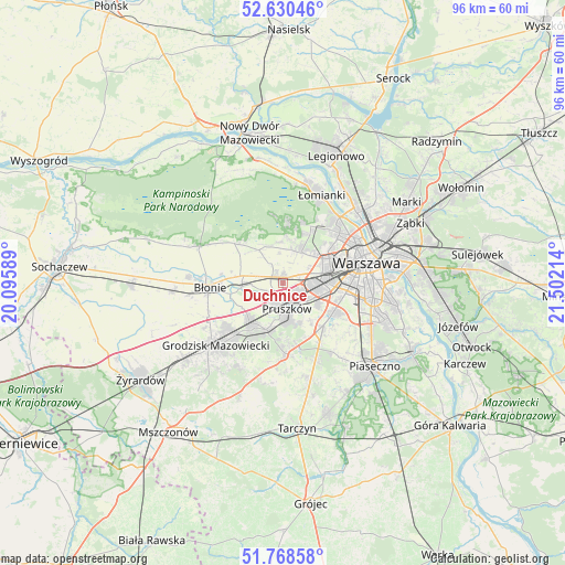
Duchnice GPS coordinates[2]
52° 12' 5.796" North, 20° 47' 56.436" East
| Map corner | latitude | longitude |
|---|---|---|
| Upper-left | 52.63046°, | 20.09589° |
| Center: | 52.20161°, | 20.79901° |
| Lower-right: | 51.76858°, | 21.50214° |
| Map W x H: | 95.8×95.8 km | = 59.5×59.5mi |
| max Lat: | 54.83135° ⇑29.8% North |
| Duchnice: | 52.20161° |
| min Lat: | ⇓70.2% South 49.21328° |
| min Long | Duchnice | max Long |
| 14.20249° | 20.79901° | 24.03723° |
| W 69.1%⇐ | ⇒30.9% E |
Elevation
Elevation of Duchnice is 96 m = 315 ft, and this is 95.4 m = 313 ft below average elevation for this country.
| Max E: |
974 m = 3196 ft | 81.8% |
| Avg. | 191.4 m = 628 ft | |
| Duchnice | 96 m = 315 ft | |
Min E: |
-3 m = -10 ft | 18.2% |
See also: Poland elevation on elevation.city.
Geographical zone
Duchnice is located in North temperate zone (between Tropic of Cancer and the Arctic Circle). Distance of this North polar circle is 1596.9 km =992.3 mi to North.| Distance of | km | miles | from Duchnice |
|---|---|---|---|
| North Pole | 4202.8 | 2611.5 | to North |
| Arctic Circle | 1596.9 | 992.3 | to North |
| Tropic Cancer | 3198.4 | 1987.4 | to South |
| Equator | 5804.3 | 3606.6 | to South |


Nearby cities:
15 places around Duchnice: (largest is in red/bold)
• Babice
6.5 km =4 mi,  32°
32°
• Granica
7.6 km =4.7 mi,  177°
177°
• Józefów
7.1 km =4.4 mi,  263°
263°
• Kanie
7.3 km =4.5 mi,  196°
196°
• Komorów
6.3 km =3.9 mi,  169°
169°
• Michałowice
6.4 km =4 mi,  118°
118°
• Otrębusy
8.5 km =5.3 mi, 197°
• Ołtarzew
2.9 km =1.8 mi,  292°
292°
• Ożarów Mazowiecki
1 km =0.6 mi,  352°
352°
• Piastów
3.4 km =2.1 mi, 124°
• Pruszków
3.5 km =2.2 mi, 165°
• Reguły
5.3 km =3.3 mi, 123°
• Stare Babice
6.9 km =4.3 mi,  20°
20°
• Ursus
5.8 km =3.6 mi,  97°
97°
• Zielonki-Wieś
5.8 km =3.6 mi,  4°
4°
Sources, notices
• [Note1] Compared only with cities in Poland existing in our database
• [Src1] Map data: © OpenStreetMap contributors (CC-BY-SA)
• [Src2] Other city data from geonames.org with taken over terms of usage.
• [Src3] Geographical zone / Annual Mean Temperature by Robert A. Rohde @ Wikipedia
