Biskupin geodata
Biskupin (Lower Silesia) is a section of populated place; located in Poland in Europe/Warsaw (GMT+2) time zone. With population of 11,292 people, there are 411 cities with bigger population in this country. Compared to other cities in Poland, 52.5% of cities are located further ↑North; 83.2% of cities are located further →East and 71.1% of cities have higher elevation than Biskupin. Note1
Administrative division(s):
- Level 1: Lower Silesia
- Level 2: Wrocław
- Level 3: Wrocław
- Level 4: Biskupin - Sępolno - Dąbie - Bartoszowice


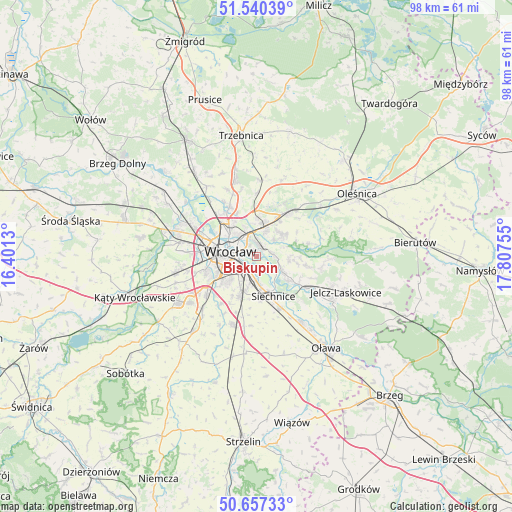
Biskupin GPS coordinates[2]
51° 6' 3.492" North, 17° 6' 15.912" East
| Map corner | latitude | longitude |
|---|---|---|
| Upper-left | 51.54039°, | 16.4013° |
| Center: | 51.10097°, | 17.10442° |
| Lower-right: | 50.65733°, | 17.80755° |
| Map W x H: | 98.2×98.2 km | = 61×61mi |
| max Lat: | 54.83135° ⇑52.5% North |
| Biskupin: | 51.10097° |
| min Lat: | ⇓47.5% South 49.21328° |
| min Long | Biskupin | max Long |
| 14.20249° | 17.10442° | 24.03723° |
| W 16.8%⇐ | ⇒83.2% E |
Elevation
Elevation of Biskupin is 119 m = 390 ft, and this is 72.4 m = 238 ft below average elevation for this country.
| Max E: |
974 m = 3196 ft | 71.1% |
| Avg. | 191.4 m = 628 ft | |
| Biskupin | 119 m = 390 ft | |
Min E: |
-3 m = -10 ft | 28.9% |
See also: Poland elevation on elevation.city.
Geographical zone
Biskupin is located in North temperate zone (between Tropic of Cancer and the Arctic Circle). Distance of this North polar circle is 1719.3 km =1068.3 mi to North.| Distance of | km | miles | from Biskupin |
|---|---|---|---|
| North Pole | 4325.2 | 2687.6 | to North |
| Arctic Circle | 1719.3 | 1068.3 | to North |
| Tropic Cancer | 3076 | 1911.3 | to South |
| Equator | 5681.9 | 3530.6 | to South |


Nearby cities:
15 places around Biskupin: (largest is in red/bold)
• Dąbie
1.7 km =1.1 mi,  287°
287°
• Kowale-Popiele
3.3 km =2.1 mi,  356°
356°
• Księże Małe-Księże Wielkie
3.3 km =2.1 mi,  199°
199°
• Osiedle Henrykowskie
3.8 km =2.4 mi,  251°
251°
• Rakowiec-Opatowice
1.3 km =0.8 mi,  184°
184°
• Rejon alei Kromera
4.3 km =2.7 mi,  327°
327°
• Rejon placu Grunwaldzkiego
3.5 km =2.2 mi,  300°
300°
• Rejon ulicy Traugutta
3.9 km =2.4 mi,  272°
272°
• Strachocin-Wojnów
3.3 km =2.1 mi,  82°
82°
• Swojczyce
2.2 km =1.4 mi,  41°
41°
• Szczytniki
2.2 km =1.4 mi,  308°
308°
• Sępolno
1 km =0.6 mi,  350°
350°
• Zacisze
3.2 km =2 mi,  319°
319°
• Zalesie i Stadion
2.3 km =1.4 mi,  337°
337°
• Zgorzelisko
4.6 km =2.9 mi,  26°
26°
Sources, notices
• [Note1] Compared only with cities in Poland existing in our database
• [Src1] Map data: © OpenStreetMap contributors (CC-BY-SA)
• [Src2] Other city data from geonames.org with taken over terms of usage.
• [Src3] Geographical zone / Annual Mean Temperature by Robert A. Rohde @ Wikipedia
