Kowale-Popiele geodata
Kowale-Popiele (Lower Silesia) is a section of populated place; located in Poland in Europe/Warsaw (GMT+2) time zone. With population of 2,254 people, there are 1336 cities with bigger population in this country. Compared to other cities in Poland, 51.5% of cities are located further ↑North; 83.2% of cities are located further →East and 73.5% of cities have higher elevation than Kowale-Popiele. Note1
Administrative division(s):
- Level 1: Lower Silesia
- Level 2: Wrocław
- Level 3: Wrocław
- Level 4: Kowale


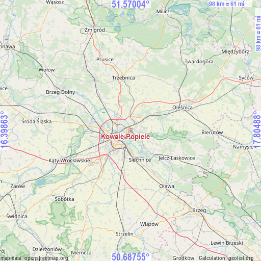
Kowale-Popiele GPS coordinates[2]
51° 7' 51.24" North, 17° 6' 6.3" East
| Map corner | latitude | longitude |
|---|---|---|
| Upper-left | 51.57004°, | 16.39863° |
| Center: | 51.1309°, | 17.10175° |
| Lower-right: | 50.68755°, | 17.80488° |
| Map W x H: | 98.1×98.1 km | = 61×61mi |
| max Lat: | 54.83135° ⇑51.5% North |
| Kowale-Popiele: | 51.1309° |
| min Lat: | ⇓48.5% South 49.21328° |
| min Long | Kowale-Popiele | max Long |
| 14.20249° | 17.10175° | 24.03723° |
| W 16.8%⇐ | ⇒83.2% E |
Elevation
Elevation of Kowale-Popiele is 114 m = 374 ft, and this is 77.4 m = 254 ft below average elevation for this country.
| Max E: |
974 m = 3196 ft | 73.5% |
| Avg. | 191.4 m = 628 ft | |
| Kowale-Popiele | 114 m = 374 ft | |
Min E: |
-3 m = -10 ft | 26.5% |
See also: Poland elevation on elevation.city.
Geographical zone
Kowale-Popiele is located in North temperate zone (between Tropic of Cancer and the Arctic Circle). Distance of this North polar circle is 1716 km =1066.3 mi to North.| Distance of | km | miles | from Kowale-Popiele |
|---|---|---|---|
| North Pole | 4321.8 | 2685.4 | to North |
| Arctic Circle | 1716 | 1066.3 | to North |
| Tropic Cancer | 3079.3 | 1913.4 | to South |
| Equator | 5685.2 | 3532.6 | to South |


Nearby cities:
15 places around Kowale-Popiele: (largest is in red/bold)
• Biskupin
3.3 km =2.1 mi,  176°
176°
• Dąbie
3.1 km =1.9 mi,  207°
207°
• Karłowice
3.7 km =2.3 mi,  288°
288°
• Psie Pole Południe-Kiełczów
2.6 km =1.6 mi,  43°
43°
• Psie Pole Północ
2.5 km =1.6 mi,  11°
11°
• Rejon alei Kromera
2.2 km =1.4 mi,  278°
278°
• Rejon placu Grunwaldzkiego
3.2 km =2 mi,  240°
240°
• Sołtysowice
3.2 km =2 mi,  318°
318°
• Swojczyce
2.4 km =1.5 mi,  135°
135°
• Szczytniki
2.5 km =1.6 mi,  218°
218°
• Sępolno
2.3 km =1.4 mi, 179°
• Wilczyce
3.7 km =2.3 mi,  92°
92°
• Zacisze
2.1 km =1.3 mi,  245°
245°
• Zalesie i Stadion
1.4 km =0.9 mi, 208°
• Zgorzelisko
2.4 km =1.5 mi,  69°
69°
Sources, notices
• [Note1] Compared only with cities in Poland existing in our database
• [Src1] Map data: © OpenStreetMap contributors (CC-BY-SA)
• [Src2] Other city data from geonames.org with taken over terms of usage.
• [Src3] Geographical zone / Annual Mean Temperature by Robert A. Rohde @ Wikipedia
