Tarnawa Dolna geodata
Tarnawa Dolna (Subcarpathian) is a populated place; located in Poland in Europe/Warsaw (GMT+2) time zone. With population of 940 people, there are 2606 cities with bigger population in this country. Compared to other cities in Poland, 98.6% of cities are located further ↑North; 88.1% of cities are located further ←West and 89.4% of cities have lower elevation than Tarnawa Dolna. Note1


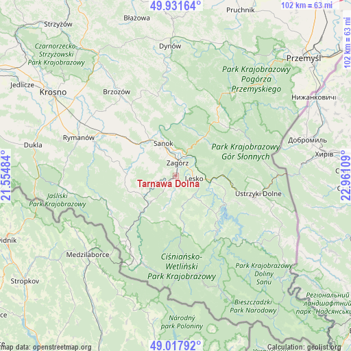
Tarnawa Dolna GPS coordinates[2]
49° 28' 36.876" North, 22° 15' 28.656" East
| Map corner | latitude | longitude |
|---|---|---|
| Upper-left | 49.93164°, | 21.55484° |
| Center: | 49.47691°, | 22.25796° |
| Lower-right: | 49.01792°, | 22.96109° |
| Map W x H: | 101.6×101.6 km | = 63.1×63.1mi |
| max Lat: | 54.83135° ⇑98.6% North |
| Tarnawa Dolna: | 49.47691° |
| min Lat: | ⇓1.4% South 49.21328° |
| min Long | Tarnawa Dolna | max Long |
| 14.20249° | 22.25796° | 24.03723° |
| W 88.1%⇐ | ⇒11.9% E |
Elevation
Elevation of Tarnawa Dolna is 320 m = 1050 ft, and this is 128.6 m = 422 ft above average elevation for this country.
| Max E: |
974 m = 3196 ft | 10.6% |
| Tarnawa Dolna | 320 m 1050 ft | |
| Avg. | 191.4 m = 628 ft | |
Min E: |
-3 m = -10 ft | 89.4% |
See also: Poland elevation on elevation.city.
Geographical zone
Tarnawa Dolna is located in North temperate zone (between Tropic of Cancer and the Arctic Circle). Distance of this North polar circle is 1899.9 km =1180.5 mi to North.| Distance of | km | miles | from Tarnawa Dolna |
|---|---|---|---|
| North Pole | 4505.7 | 2799.7 | to North |
| Arctic Circle | 1899.9 | 1180.5 | to North |
| Tropic Cancer | 2895.4 | 1799.1 | to South |
| Equator | 5501.3 | 3418.3 | to South |


Nearby cities:
15 places around Tarnawa Dolna: (largest is in red/bold)
• Bukowsko
14.1 km =8.8 mi,  271°
271°
• Czaszyn
4.4 km =2.7 mi,  223°
223°
• Lesko
5.3 km =3.3 mi,  98°
98°
• Myczkowce
11.8 km =7.3 mi,  111°
111°
• Niebieszczany
7.9 km =4.9 mi,  291°
291°
• Olszanica
13.4 km =8.3 mi,  89°
89°
• Pisarowce
14.8 km =9.2 mi,  307°
307°
• Poraż
2.6 km =1.6 mi, 292°
• Rzepedź
15.9 km =9.9 mi, 221°
• Sanok
9.5 km =5.9 mi,  336°
336°
• Tarnawa Górna
2.2 km =1.4 mi,  183°
183°
• Tyrawa Wołoska
13.8 km =8.6 mi,  35°
35°
• Uherce Mineralne
10.2 km =6.3 mi, 97°
• Zagórz
4.2 km =2.6 mi,  8°
8°
• Łukowe
5.6 km =3.5 mi,  192°
192°
Sources, notices
• [Note1] Compared only with cities in Poland existing in our database
• [Src1] Map data: © OpenStreetMap contributors (CC-BY-SA)
• [Src2] Other city data from geonames.org with taken over terms of usage.
• [Src3] Geographical zone / Annual Mean Temperature by Robert A. Rohde @ Wikipedia
