Bukowsko geodata
Bukowsko (Subcarpathian) is a seat of a third-order administrative division; located in Poland in Europe/Warsaw (GMT+2) time zone. With population of 1,700 people, there are 1678 cities with bigger population in this country. Compared to other cities in Poland, 98.5% of cities are located further ↑North; 85.6% of cities are located further ←West and 94.1% of cities have lower elevation than Bukowsko. Note1


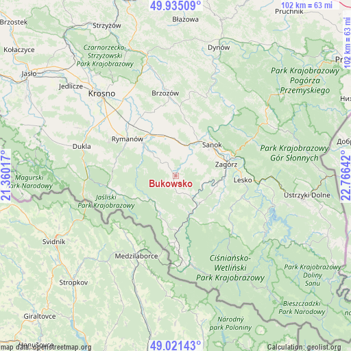
Bukowsko GPS coordinates[2]
49° 28' 49.404" North, 22° 3' 47.844" East
| Map corner | latitude | longitude |
|---|---|---|
| Upper-left | 49.93509°, | 21.36017° |
| Center: | 49.48039°, | 22.06329° |
| Lower-right: | 49.02143°, | 22.76642° |
| Map W x H: | 101.6×101.6 km | = 63.1×63.1mi |
| max Lat: | 54.83135° ⇑98.5% North |
| Bukowsko: | 49.48039° |
| min Lat: | ⇓1.5% South 49.21328° |
| min Long | Bukowsko | max Long |
| 14.20249° | 22.06329° | 24.03723° |
| W 85.6%⇐ | ⇒14.4% E |
Elevation
Elevation of Bukowsko is 392 m = 1286 ft, and this is 200.6 m = 658 ft above average elevation for this country.
| Max E: |
974 m = 3196 ft | 5.9% |
| Bukowsko | 392 m 1286 ft | |
| Avg. | 191.4 m = 628 ft | |
Min E: |
-3 m = -10 ft | 94.1% |
See also: Poland elevation on elevation.city.
Geographical zone
Bukowsko is located in North temperate zone (between Tropic of Cancer and the Arctic Circle). Distance of this North polar circle is 1899.5 km =1180.3 mi to North.| Distance of | km | miles | from Bukowsko |
|---|---|---|---|
| North Pole | 4505.4 | 2799.5 | to North |
| Arctic Circle | 1899.5 | 1180.3 | to North |
| Tropic Cancer | 2895.8 | 1799.4 | to South |
| Equator | 5501.7 | 3418.6 | to South |


Nearby cities:
15 places around Bukowsko: (largest is in red/bold)
• Czaszyn
11.6 km =7.2 mi,  107°
107°
• Długie
11 km =6.8 mi,  352°
352°
• Głębokie
13.2 km =8.2 mi,  303°
303°
• Kostarowce
12.3 km =7.6 mi,  17°
17°
• Niebieszczany
7.2 km =4.5 mi,  69°
69°
• Nowosielce-Gniewosz
9.8 km =6.1 mi,  2°
2°
• Pielnia
6.4 km =4 mi, 353°
• Pisarowce
9 km =5.6 mi, 15°
• Poraż
11.7 km =7.3 mi,  86°
86°
• Rzepedź
12.8 km =8 mi,  164°
164°
• Sanok
13.3 km =8.3 mi,  50°
50°
• Sieniawa
13.6 km =8.5 mi,  313°
313°
• Tarnawa Dolna
14.1 km =8.8 mi, 91°
• Zarszyn
11.8 km =7.3 mi,  342°
342°
• Łukowe
14.1 km =8.8 mi, 114°
Sources, notices
• [Note1] Compared only with cities in Poland existing in our database
• [Src1] Map data: © OpenStreetMap contributors (CC-BY-SA)
• [Src2] Other city data from geonames.org with taken over terms of usage.
• [Src3] Geographical zone / Annual Mean Temperature by Robert A. Rohde @ Wikipedia
