Puchaczów geodata
Puchaczów (Lublin) is a seat of a third-order administrative division; located in Poland in Europe/Warsaw (GMT+2) time zone. With population of 817 people, there are 2829 cities with bigger population in this country. Compared to other cities in Poland, 53.4% of cities are located further ↓South; 96% of cities are located further ←West and 51.9% of cities have higher elevation than Puchaczów. Note1


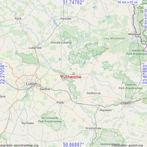
Puchaczów GPS coordinates[2]
51° 18' 37.8" North, 22° 58' 25.32" East
| Map corner | latitude | longitude |
|---|---|---|
| Upper-left | 51.74792°, | 22.27058° |
| Center: | 51.3105°, | 22.9737° |
| Lower-right: | 50.86887°, | 23.67683° |
| Map W x H: | 97.7×97.7 km | = 60.7×60.7mi |
| max Lat: | 54.83135° ⇑46.6% North |
| Puchaczów: | 51.3105° |
| min Lat: | ⇓53.4% South 49.21328° |
| min Long | Puchaczów | max Long |
| 14.20249° | 22.9737° | 24.03723° |
| W 96%⇐ | ⇒4% E |
Elevation
Elevation of Puchaczów is 167 m = 548 ft, and this is 24.4 m = 80 ft below average elevation for this country.
| Max E: |
974 m = 3196 ft | 51.9% |
| Avg. | 191.4 m = 628 ft | |
| Puchaczów | 167 m = 548 ft | |
Min E: |
-3 m = -10 ft | 48.1% |
See also: Poland elevation on elevation.city.
Geographical zone
Puchaczów is located in North temperate zone (between Tropic of Cancer and the Arctic Circle). Distance of this North polar circle is 1696 km =1053.8 mi to North.| Distance of | km | miles | from Puchaczów |
|---|---|---|---|
| North Pole | 4301.9 | 2673.1 | to North |
| Arctic Circle | 1696 | 1053.8 | to North |
| Tropic Cancer | 3099.3 | 1925.8 | to South |
| Equator | 5705.2 | 3545 | to South |


Nearby cities:
15 places around Puchaczów: (largest is in red/bold)
• Cyców
11.7 km =7.3 mi,  96°
96°
• Krasne
11.7 km =7.3 mi,  354°
354°
• Ludwin
6.2 km =3.9 mi,  309°
309°
• Mełgiew
16.2 km =10.1 mi,  234°
234°
• Milejów
9.4 km =5.8 mi,  201°
201°
• Ostrów Lubelski
22.1 km =13.7 mi,  337°
337°
• Piaski
21 km =13 mi, 204°
• Siedliszcze
18.5 km =11.5 mi,  134°
134°
• Spiczyn
15.7 km =9.8 mi,  282°
282°
• Trawniki
19.4 km =12.1 mi,  174°
174°
• Urszulin
17.9 km =11.1 mi,  58°
58°
• Uścimów Nowy
17.2 km =10.7 mi, 348°
• Uścimów Stary
17.7 km =11 mi,  355°
355°
• Łęczna
6.5 km =4 mi,  260°
260°
• Świdnik
21.8 km =13.5 mi,  242°
242°
Sources, notices
• [Note1] Compared only with cities in Poland existing in our database
• [Src1] Map data: © OpenStreetMap contributors (CC-BY-SA)
• [Src2] Other city data from geonames.org with taken over terms of usage.
• [Src3] Geographical zone / Annual Mean Temperature by Robert A. Rohde @ Wikipedia
