Pomiechówek geodata
Pomiechówek (Mazovia) is a seat of a third-order administrative division; located in Poland in Europe/Warsaw (GMT+2) time zone. With population of 936 people, there are 2617 cities with bigger population in this country. Compared to other cities in Poland, 76% of cities are located further ↓South; 68.2% of cities are located further ←West and 87.8% of cities have higher elevation than Pomiechówek. Note1


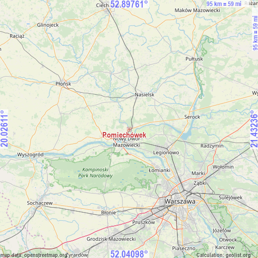
Pomiechówek GPS coordinates[2]
52° 28' 16.968" North, 20° 43' 45.228" East
| Map corner | latitude | longitude |
|---|---|---|
| Upper-left | 52.89761°, | 20.02611° |
| Center: | 52.47138°, | 20.72923° |
| Lower-right: | 52.04098°, | 21.43236° |
| Map W x H: | 95.2×95.2 km | = 59.2×59.2mi |
| max Lat: | 54.83135° ⇑24% North |
| Pomiechówek: | 52.47138° |
| min Lat: | ⇓76% South 49.21328° |
| min Long | Pomiechówek | max Long |
| 14.20249° | 20.72923° | 24.03723° |
| W 68.2%⇐ | ⇒31.8% E |
Elevation
Elevation of Pomiechówek is 82 m = 269 ft, and this is 109.4 m = 359 ft below average elevation for this country.
| Max E: |
974 m = 3196 ft | 87.8% |
| Avg. | 191.4 m = 628 ft | |
| Pomiechówek | 82 m = 269 ft | |
Min E: |
-3 m = -10 ft | 12.2% |
See also: Poland elevation on elevation.city.
Geographical zone
Pomiechówek is located in North temperate zone (between Tropic of Cancer and the Arctic Circle). Distance of this North polar circle is 1566.9 km =973.6 mi to North.| Distance of | km | miles | from Pomiechówek |
|---|---|---|---|
| North Pole | 4172.8 | 2592.9 | to North |
| Arctic Circle | 1566.9 | 973.6 | to North |
| Tropic Cancer | 3228.4 | 2006 | to South |
| Equator | 5834.3 | 3625.3 | to South |


Nearby cities:
15 places around Pomiechówek: (largest is in red/bold)
• Brody-Parcele
1.6 km =1 mi,  62°
62°
• Dziekanów Bajkowy
15.1 km =9.4 mi,  146°
146°
• Dziekanów Leśny
15.6 km =9.7 mi, 147°
• Jabłonna
16.4 km =10.2 mi,  128°
128°
• Kiełpin
15.5 km =9.6 mi,  144°
144°
• Legionowo
15.5 km =9.6 mi,  120°
120°
• Michałów-Reginów
17.1 km =10.6 mi,  110°
110°
• Nasielsk
14 km =8.7 mi,  21°
21°
• Nowy Dwór Mazowiecki
4.7 km =2.9 mi,  190°
190°
• Stanisławów
17.3 km =10.7 mi, 112°
• Wieliszew
16.3 km =10.1 mi,  97°
97°
• Zakroczym
9 km =5.6 mi,  242°
242°
• Załuski
14.3 km =8.9 mi,  288°
288°
• Łajski
15.7 km =9.8 mi, 107°
• Łomna
10.4 km =6.5 mi,  161°
161°
Sources, notices
• [Note1] Compared only with cities in Poland existing in our database
• [Src1] Map data: © OpenStreetMap contributors (CC-BY-SA)
• [Src2] Other city data from geonames.org with taken over terms of usage.
• [Src3] Geographical zone / Annual Mean Temperature by Robert A. Rohde @ Wikipedia
