Nasielsk geodata
Nasielsk (Mazovia) is a seat of a third-order administrative division; located in Poland in Europe/Warsaw (GMT+2) time zone. With population of 7,445 people, there are 521 cities with bigger population in this country. Compared to other cities in Poland, 77.8% of cities are located further ↓South; 69.1% of cities are located further ←West and 76% of cities have higher elevation than Nasielsk. Note1


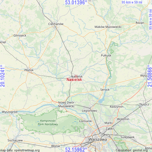
Nasielsk GPS coordinates[2]
52° 35' 19.932" North, 20° 48' 19.908" East
| Map corner | latitude | longitude |
|---|---|---|
| Upper-left | 53.01396°, | 20.10241° |
| Center: | 52.58887°, | 20.80553° |
| Lower-right: | 52.15962°, | 21.50866° |
| Map W x H: | 95×95 km | = 59×59mi |
| max Lat: | 54.83135° ⇑22.2% North |
| Nasielsk: | 52.58887° |
| min Lat: | ⇓77.8% South 49.21328° |
| min Long | Nasielsk | max Long |
| 14.20249° | 20.80553° | 24.03723° |
| W 69.1%⇐ | ⇒30.9% E |
Elevation
Elevation of Nasielsk is 108 m = 354 ft, and this is 83.4 m = 274 ft below average elevation for this country.
| Max E: |
974 m = 3196 ft | 76% |
| Avg. | 191.4 m = 628 ft | |
| Nasielsk | 108 m = 354 ft | |
Min E: |
-3 m = -10 ft | 24% |
See also: Poland elevation on elevation.city.
Geographical zone
Nasielsk is located in North temperate zone (between Tropic of Cancer and the Arctic Circle). Distance of this North polar circle is 1553.8 km =965.5 mi to North.| Distance of | km | miles | from Nasielsk |
|---|---|---|---|
| North Pole | 4159.7 | 2584.7 | to North |
| Arctic Circle | 1553.8 | 965.5 | to North |
| Tropic Cancer | 3241.4 | 2014.1 | to South |
| Equator | 5847.3 | 3633.3 | to South |


Nearby cities:
15 places around Nasielsk: (largest is in red/bold)
• Brody-Parcele
12.9 km =8 mi,  197°
197°
• Gzy
19.3 km =12 mi,  28°
28°
• Gąsocin
17.7 km =11 mi,  339°
339°
• Joniec
15.2 km =9.4 mi,  275°
275°
• Nowe Miasto
14.1 km =8.8 mi,  302°
302°
• Nowy Dwór Mazowiecki
18.6 km =11.6 mi, 198°
• Pokrzywnica
14.9 km =9.3 mi,  76°
76°
• Pomiechówek
14 km =8.7 mi, 201°
• Serock
19.8 km =12.3 mi,  116°
116°
• Wieliszew
18.8 km =11.7 mi,  144°
144°
• Winnica
11 km =6.8 mi,  56°
56°
• Zakroczym
21.7 km =13.5 mi,  217°
217°
• Załuski
20.6 km =12.8 mi,  245°
245°
• Łajski
20.3 km =12.6 mi,  151°
151°
• Świercze
9.5 km =5.9 mi, 342°
Sources, notices
• [Note1] Compared only with cities in Poland existing in our database
• [Src1] Map data: © OpenStreetMap contributors (CC-BY-SA)
• [Src2] Other city data from geonames.org with taken over terms of usage.
• [Src3] Geographical zone / Annual Mean Temperature by Robert A. Rohde @ Wikipedia
