Cisna geodata
Cisna (Subcarpathian) is a seat of a third-order administrative division; located in Poland in Europe/Warsaw (GMT+2) time zone. With population of 460 people, there are 3556 cities with bigger population in this country. Compared to other cities in Poland, 100% of cities are located further ↑North; 89.3% of cities are located further ←West and 98.2% of cities have lower elevation than Cisna. Note1


Cisna GPS coordinates[2]
49° 12' 47.808" North, 22° 19' 40.62" East
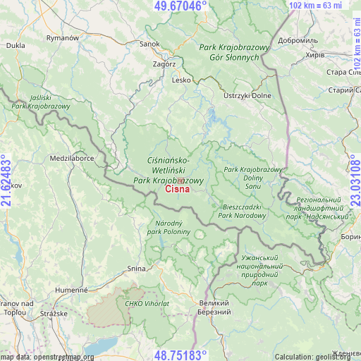
| Map corner | latitude | longitude |
|---|---|---|
| Upper-left | 49.67046°, | 21.62483° |
| Center: | 49.21328°, | 22.32795° |
| Lower-right: | 48.75183°, | 23.03108° |
| Map W x H: | 102.1×102.1 km | = 63.4×63.4mi |
| max Lat: | 54.83135° ⇑100% North |
| Cisna: | 49.21328° |
| min Lat: | ⇓0% South 49.21328° |
| min Long | Cisna | max Long |
| 14.20249° | 22.32795° | 24.03723° |
| W 89.3%⇐ | ⇒10.7% E |
Elevation
Elevation of Cisna is 560 m = 1837 ft, and this is 368.6 m = 1209 ft above average elevation for this country.
| Max E: |
974 m = 3196 ft | 1.8% |
| Cisna | 560 m 1837 ft | |
| Avg. | 191.4 m = 628 ft | |
Min E: |
-3 m = -10 ft | 98.2% |
See also: Poland elevation on elevation.city.
Geographical zone
Cisna is located in North temperate zone (between Tropic of Cancer and the Arctic Circle). Distance of this North polar circle is 1929.2 km =1198.7 mi to North.| Distance of | km | miles | from Cisna |
|---|---|---|---|
| North Pole | 4535.1 | 2818 | to North |
| Arctic Circle | 1929.2 | 1198.7 | to North |
| Tropic Cancer | 2866.1 | 1780.9 | to South |
| Equator | 5472 | 3400.1 | to South |


Nearby cities:
15 places around Cisna: (largest is in red/bold)
• Baligród
13.4 km =8.3 mi,  346°
346°
• Czarna
27.4 km =17 mi,  61°
61°
• Czaszyn
27.4 km =17 mi,  342°
342°
• Komańcza
23.9 km =14.9 mi,  305°
305°
• Lesko
28.6 km =17.8 mi,  0°
0°
• Lutowiska
26.8 km =16.7 mi,  80°
80°
• Myczkowce
25.7 km =16 mi,  13°
13°
• Olszanica
30.5 km =19 mi,  15°
15°
• Polańczyk
18.7 km =11.6 mi, 21°
• Rzepedź
23.4 km =14.5 mi,  318°
318°
• Tarnawa Dolna
29.7 km =18.5 mi, 350°
• Tarnawa Górna
27.6 km =17.1 mi, 349°
• Uherce Mineralne
28.4 km =17.6 mi, 10°
• Ustrzyki Dolne
30.9 km =19.2 mi,  38°
38°
• Łukowe
24.7 km =15.3 mi, 345°
Sources, notices
• [Note1] Compared only with cities in Poland existing in our database
• [Src1] Map data: © OpenStreetMap contributors (CC-BY-SA)
• [Src2] Other city data from geonames.org with taken over terms of usage.
• [Src3] Geographical zone / Annual Mean Temperature by Robert A. Rohde @ Wikipedia
