Białka Tatrzańska geodata
Białka Tatrzańska (Lesser Poland) is a populated place; located in Poland in Europe/Warsaw (GMT+2) time zone. With population of 2,200 people, there are 1362 cities with bigger population in this country. Compared to other cities in Poland, 99.6% of cities are located further ↑North; 60.1% of cities are located further ←West and 99.7% of cities have lower elevation than Białka Tatrzańska. Note1
Administrative division(s):
- Level 1: Lesser Poland
- Level 2: Powiat tatrzański
- Level 3: Bukowina Tatrzańska


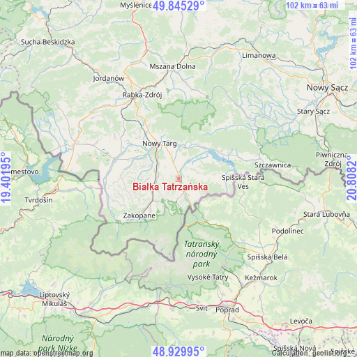
Białka Tatrzańska GPS coordinates[2]
49° 23' 23.1" North, 20° 6' 18.252" East
| Map corner | latitude | longitude |
|---|---|---|
| Upper-left | 49.84529°, | 19.40195° |
| Center: | 49.38975°, | 20.10507° |
| Lower-right: | 48.92995°, | 20.8082° |
| Map W x H: | 101.8×101.8 km | = 63.3×63.3mi |
| max Lat: | 54.83135° ⇑99.6% North |
| Białka Tatrzańska: | 49.38975° |
| min Lat: | ⇓0.4% South 49.21328° |
| min Long | Białka Tatrza� | max Long |
| 14.20249° | 20.10507° | 24.03723° |
| W 60.1%⇐ | ⇒39.9% E |
Elevation
Elevation of Białka Tatrzańska is 692 m = 2270 ft, and this is 500.6 m = 1642 ft above average elevation for this country.
| Max E: |
974 m = 3196 ft | 0.3% |
| Białka Tatrzańska | 692 m 2270 ft | |
| Avg. | 191.4 m = 628 ft | |
Min E: |
-3 m = -10 ft | 99.7% |
See also: Poland elevation on elevation.city.
Geographical zone
Białka Tatrzańska is located in North temperate zone (between Tropic of Cancer and the Arctic Circle). Distance of this North polar circle is 1909.5 km =1186.5 mi to North.| Distance of | km | miles | from Białka Tatrzańska |
|---|---|---|---|
| North Pole | 4515.4 | 2805.7 | to North |
| Arctic Circle | 1909.5 | 1186.5 | to North |
| Tropic Cancer | 2885.7 | 1793.1 | to South |
| Equator | 5491.6 | 3412.3 | to South |


Nearby cities:
15 places around Białka Tatrzańska: (largest is in red/bold)
• Biały Dunajec
7.2 km =4.5 mi,  255°
255°
• Bukowina Tatrzańska
5.2 km =3.2 mi,  177°
177°
• Czarna Góra
2.3 km =1.4 mi,  128°
128°
• Dębno
11.2 km =7 mi,  40°
40°
• Frydman
11.2 km =7 mi,  53°
53°
• Leśnica
3.5 km =2.2 mi,  290°
290°
• Ludźmierz
12.3 km =7.6 mi,  313°
313°
• Nowy Targ
11.1 km =6.9 mi,  331°
331°
• Ostrowsko
9.6 km =6 mi,  358°
358°
• Poronin
9.4 km =5.8 mi,  232°
232°
• Szaflary
7 km =4.3 mi, 305°
• Szlembark
12.3 km =7.6 mi, 39°
• Waksmund
10.5 km =6.5 mi,  348°
348°
• Łapsze Niżne
10.1 km =6.3 mi,  84°
84°
• Łopuszna
9.4 km =5.8 mi,  11°
11°
Sources, notices
• [Note1] Compared only with cities in Poland existing in our database
• [Src1] Map data: © OpenStreetMap contributors (CC-BY-SA)
• [Src2] Other city data from geonames.org with taken over terms of usage.
• [Src3] Geographical zone / Annual Mean Temperature by Robert A. Rohde @ Wikipedia
