Fuig geodata
Fuig (Guánica) is a populated place; located in Puerto Rico in America/Puerto_Rico (GMT-4) time zone. With population of 1,204 people, there are 196 cities with bigger population in this country. Compared to other cities in Puerto Rico, 92.4% of cities are located further ↑North; 82.7% of cities are located further →East and 94.7% of cities have higher elevation than Fuig. Note1


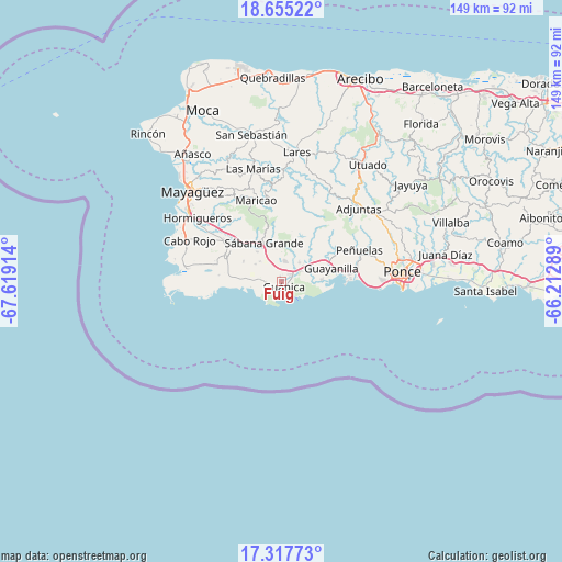
Fuig GPS coordinates[2]
17° 59' 15.864" North, 66° 54' 57.636" West
| Map corner | latitude | longitude |
|---|---|---|
| Upper-left | 18.65522°, | -67.61914° |
| Center: | 17.98774°, | -66.91601° |
| Lower-right: | 17.31773°, | -66.21289° |
| Map W x H: | 148.7×148.7 km | = 92.4×92.4mi |
| max Lat: | 18.50078° ⇑92.4% North |
| Fuig: | 17.98774° |
| min Lat: | ⇓7.6% South 17.95358° |
| min Long | Fuig | max Long |
| -67.2499° | -66.91601° | -65.30099° |
| W 17.3%⇐ | ⇒82.7% E |
Elevation
Elevation of Fuig is 6 m = 20 ft, and this is 94.5 m = 310 ft below average elevation for this country.
| Max E: |
655 m = 2149 ft | 94.7% |
| Avg. | 100.5 m = 330 ft | |
| Fuig | 6 m = 20 ft | |
Min E: |
1 m = 3 ft | 5.3% |
See also: Puerto Rico elevation on elevation.city.
Geographical zone
Fuig is located in North Torrid zone (between Equator and Tropic of Cancer). Distance of this Northern Tropic circle is 605.9 km =376.5 mi to North.| Distance of | km | miles | from Fuig |
|---|---|---|---|
| North Pole | 8007 | 4975.3 | to North |
| Arctic Circle | 5401.1 | 3356.1 | to North |
| Tropic Cancer | 605.9 | 376.5 | to North |
| Equator | 2000 | 1242.7 | to South |


Nearby cities:
15 places around Fuig: (largest is in red/bold)
• Guayanilla
13.6 km =8.5 mi,  75°
75°
• Guánica
2 km =1.2 mi,  154°
154°
• Indios
10.2 km =6.3 mi,  86°
86°
• La Parguera
13.9 km =8.6 mi,  264°
264°
• Lajas
16.7 km =10.4 mi,  294°
294°
• Liborio Negron Torres
6.8 km =4.2 mi,  335°
335°
• Lluveras
5.7 km =3.5 mi,  12°
12°
• Magas Arriba
15.9 km =9.9 mi, 77°
• Maria Antonia
3 km =1.9 mi,  110°
110°
• Palmarejo
18 km =11.2 mi, 288°
• Palomas
5.4 km =3.4 mi,  57°
57°
• Sabana Grande
11.1 km =6.9 mi,  334°
334°
• San Germán
17.2 km =10.7 mi,  307°
307°
• Santo Domingo
19.2 km =11.9 mi, 64°
• Yauco
8.7 km =5.4 mi,  53°
53°
Sources, notices
• [Note1] Compared only with cities in Puerto Rico existing in our database
• [Src1] Map data: © OpenStreetMap contributors (CC-BY-SA)
• [Src2] Other city data from geonames.org with taken over terms of usage.
• [Src3] Geographical zone / Annual Mean Temperature by Robert A. Rohde @ Wikipedia
