Liborio Negron Torres geodata
Liborio Negron Torres (Sabana Grande) is a populated place; located in Puerto Rico in America/Puerto_Rico (GMT-4) time zone. With population of 1,303 people, there are 188 cities with bigger population in this country. Compared to other cities in Puerto Rico, 79.1% of cities are located further ↑North; 84.4% of cities are located further →East and 56.4% of cities have lower elevation than Liborio Negron Torres. Note1


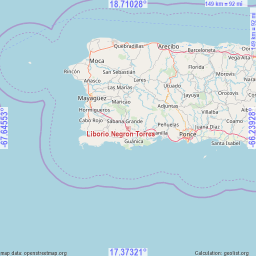
Liborio Negron Torres GPS coordinates[2]
18° 2' 34.872" North, 66° 56' 32.64" West
| Map corner | latitude | longitude |
|---|---|---|
| Upper-left | 18.71028°, | -67.64553° |
| Center: | 18.04302°, | -66.9424° |
| Lower-right: | 17.37321°, | -66.23928° |
| Map W x H: | 148.7×148.7 km | = 92.4×92.4mi |
| max Lat: | 18.50078° ⇑79.1% North |
| Liborio Negron Torres: | 18.04302° |
| min Lat: | ⇓20.9% South 17.95358° |
| min Long | Liborio Negron | max Long |
| -67.2499° | -66.9424° | -65.30099° |
| W 15.6%⇐ | ⇒84.4% E |
Elevation
Elevation of Liborio Negron Torres is 64 m = 210 ft, and this is 36.5 m = 120 ft below average elevation for this country.
| Max E: |
655 m = 2149 ft | 43.6% |
| Avg. | 100.5 m = 330 ft | |
| Liborio Negron Torres | 64 m = 210 ft | |
Min E: |
1 m = 3 ft | 56.4% |
See also: Puerto Rico elevation on elevation.city.
Geographical zone
Liborio Negron Torres is located in North Torrid zone (between Equator and Tropic of Cancer). Distance of this Northern Tropic circle is 599.7 km =372.6 mi to North.| Distance of | km | miles | from Liborio Negron Torres |
|---|---|---|---|
| North Pole | 8000.9 | 4971.5 | to North |
| Arctic Circle | 5395 | 3352.3 | to North |
| Tropic Cancer | 599.7 | 372.6 | to North |
| Equator | 2006.2 | 1246.6 | to South |


Nearby cities:
15 places around Liborio Negron Torres: (largest is in red/bold)
• Fuig
6.8 km =4.2 mi,  155°
155°
• Guayanilla
16.1 km =10 mi,  99°
99°
• Guánica
8.7 km =5.4 mi, 155°
• Indios
14.1 km =8.8 mi,  112°
112°
• La Parguera
13.4 km =8.3 mi,  235°
235°
• Lajas
12.4 km =7.7 mi,  273°
273°
• Lluveras
4 km =2.5 mi, 97°
• Maria Antonia
9.1 km =5.7 mi,  142°
142°
• Maricao
15.8 km =9.8 mi,  345°
345°
• Palmarejo
14.2 km =8.8 mi, 268°
• Palomas
8 km =5 mi, 114°
• Sabana Eneas
15.4 km =9.6 mi,  288°
288°
• Sabana Grande
4.3 km =2.7 mi,  333°
333°
• San Germán
11.7 km =7.3 mi, 291°
• Yauco
9.8 km =6.1 mi, 95°
Sources, notices
• [Note1] Compared only with cities in Puerto Rico existing in our database
• [Src1] Map data: © OpenStreetMap contributors (CC-BY-SA)
• [Src2] Other city data from geonames.org with taken over terms of usage.
• [Src3] Geographical zone / Annual Mean Temperature by Robert A. Rohde @ Wikipedia
