Palmela geodata
Palmela (District of Setúbal) is a seat of a second-order administrative division; located in Portugal in Europe/Lisbon (GMT+1) time zone. With population of 16,934 people, there are 127 cities with bigger population in this country. Compared to other cities in Portugal, 79.6% of cities are located further ↑North; 71.4% of cities are located further →East and 67.9% of cities have lower elevation than Palmela. Note1


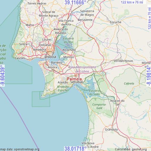
Palmela GPS coordinates[2]
38° 34' 8.472" North, 8° 54' 4.536" West
| Map corner | latitude | longitude |
|---|---|---|
| Upper-left | 39.11666°, | -9.60439° |
| Center: | 38.56902°, | -8.90126° |
| Lower-right: | 38.01718°, | -8.19814° |
| Map W x H: | 122.3×122.3 km | = 76×76mi |
| max Lat: | 42.11337° ⇑79.6% North |
| Palmela: | 38.56902° |
| min Lat: | ⇓20.4% South 32.6448° |
| min Long | Palmela | max Long |
| -31.17847° | -8.90126° | -6.27308° |
| W 28.6%⇐ | ⇒71.4% E |
Elevation
Elevation of Palmela is 190 m = 623 ft, and this is 13 m = 43 ft above average elevation for this country.
| Max E: |
1008 m = 3307 ft | 32.1% |
| Palmela | 190 m 623 ft | |
| Avg. | 177 m = 581 ft | |
Min E: |
-128 m = -420 ft | 67.9% |
See also: Portugal elevation on elevation.city.
Geographical zone
Palmela is located in North temperate zone (between Tropic of Cancer and the Arctic Circle). Distance of this Northern Tropic circle is 1682.6 km =1045.5 mi to South.| Distance of | km | miles | from Palmela |
|---|---|---|---|
| North Pole | 5718.6 | 3553.4 | to North |
| Arctic Circle | 3112.7 | 1934.1 | to North |
| Tropic Cancer | 1682.6 | 1045.5 | to South |
| Equator | 4288.5 | 2664.7 | to South |


Nearby cities:
15 places around Palmela: (largest is in red/bold)
• Aldeia de Paio Pires
16.7 km =10.4 mi,  288°
288°
• Alhos Vedros
14.3 km =8.9 mi,  311°
311°
• Arrentela
18.5 km =11.5 mi, 289°
• Azeitão
11.3 km =7 mi,  240°
240°
• Barreiro
18.2 km =11.3 mi, 305°
• Lavradio
17.1 km =10.6 mi, 310°
• Moita
11.9 km =7.4 mi,  319°
319°
• Montijo
16.6 km =10.3 mi,  337°
337°
• Pinhal Novo
7 km =4.3 mi,  351°
351°
• Quinta Do Conde
12.3 km =7.6 mi,  268°
268°
• Quinta do Anjo
3.6 km =2.2 mi, 267°
• Rosairinho
15.2 km =9.4 mi, 322°
• Santo António da Charneca
12.9 km =8 mi,  299°
299°
• Sarilhos Pequenos
14.4 km =8.9 mi,  330°
330°
• Setúbal
5.1 km =3.2 mi,  167°
167°
Sources, notices
• [Note1] Compared only with cities in Portugal existing in our database
• [Src1] Map data: © OpenStreetMap contributors (CC-BY-SA)
• [Src2] Other city data from geonames.org with taken over terms of usage.
• [Src3] Geographical zone / Annual Mean Temperature by Robert A. Rohde @ Wikipedia
