Azeitão geodata
Azeitão (District of Setúbal) is a populated place; located in Portugal in Europe/Lisbon (GMT+1) time zone. With population of 18,877 people, there are 108 cities with bigger population in this country. Compared to other cities in Portugal, 81% of cities are located further ↑North; 74.5% of cities are located further →East and 54.5% of cities have lower elevation than Azeitão. Note1


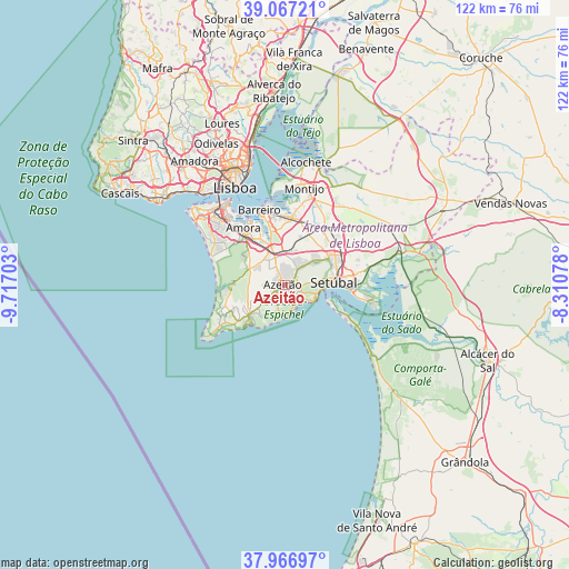
Azeitão GPS coordinates[2]
38° 31' 9.084" North, 9° 0' 50.04" West
| Map corner | latitude | longitude |
|---|---|---|
| Upper-left | 39.06721°, | -9.71703° |
| Center: | 38.51919°, | -9.0139° |
| Lower-right: | 37.96697°, | -8.31078° |
| Map W x H: | 122.3×122.3 km | = 76×76mi |
| max Lat: | 42.11337° ⇑81% North |
| Azeitão: | 38.51919° |
| min Lat: | ⇓19% South 32.6448° |
| min Long | Azeitão | max Long |
| -31.17847° | -9.0139° | -6.27308° |
| W 25.5%⇐ | ⇒74.5% E |
Elevation
Elevation of Azeitão is 127 m = 417 ft, and this is 50 m = 164 ft below average elevation for this country.
| Max E: |
1008 m = 3307 ft | 45.5% |
| Avg. | 177 m = 581 ft | |
| Azeitão | 127 m = 417 ft | |
Min E: |
-128 m = -420 ft | 54.5% |
See also: Portugal elevation on elevation.city.
Geographical zone
Azeitão is located in North temperate zone (between Tropic of Cancer and the Arctic Circle). Distance of this Northern Tropic circle is 1677 km =1042 mi to South.| Distance of | km | miles | from Azeitão |
|---|---|---|---|
| North Pole | 5724.1 | 3556.8 | to North |
| Arctic Circle | 3118.2 | 1937.6 | to North |
| Tropic Cancer | 1677 | 1042 | to South |
| Equator | 4282.9 | 2661.3 | to South |


Nearby cities:
15 places around Azeitão: (largest is in red/bold)
• Aldeia de Paio Pires
12.4 km =7.7 mi,  330°
330°
• Alhos Vedros
15.1 km =9.4 mi,  356°
356°
• Amora
15.1 km =9.4 mi,  324°
324°
• Arrentela
14 km =8.7 mi, 327°
• Barreiro
16.8 km =10.4 mi,  342°
342°
• Lavradio
16.9 km =10.5 mi,  348°
348°
• Moita
14.8 km =9.2 mi,  7°
7°
• Palmela
11.3 km =7 mi,  60°
60°
• Pinhal Novo
15.2 km =9.4 mi,  34°
34°
• Quinta Do Conde
5.7 km =3.5 mi, 333°
• Quinta do Anjo
8.2 km =5.1 mi,  49°
49°
• Santo António da Charneca
11.9 km =7.4 mi, 353°
• Seixal
15.4 km =9.6 mi, 330°
• Sesimbra
11.3 km =7 mi,  222°
222°
• Setúbal
11 km =6.8 mi,  86°
86°
Sources, notices
• [Note1] Compared only with cities in Portugal existing in our database
• [Src1] Map data: © OpenStreetMap contributors (CC-BY-SA)
• [Src2] Other city data from geonames.org with taken over terms of usage.
• [Src3] Geographical zone / Annual Mean Temperature by Robert A. Rohde @ Wikipedia
