Arranhó geodata
Arranhó (Lisbon) is a populated place; located in Portugal in Europe/Lisbon (GMT+1) time zone. With population of 2,531 people, there are 613 cities with bigger population in this country. Compared to other cities in Portugal, 65.3% of cities are located further ↑North; 79.8% of cities are located further →East and 76% of cities have lower elevation than Arranhó. Note1


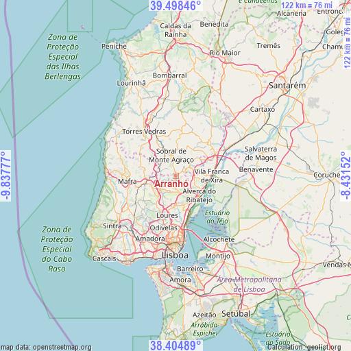
Arranhó GPS coordinates[2]
38° 57' 13.608" North, 9° 8' 4.74" West
| Map corner | latitude | longitude |
|---|---|---|
| Upper-left | 39.49846°, | -9.83777° |
| Center: | 38.95378°, | -9.13465° |
| Lower-right: | 38.40489°, | -8.43152° |
| Map W x H: | 121.6×121.6 km | = 75.6×75.6mi |
| max Lat: | 42.11337° ⇑65.3% North |
| Arranhó: | 38.95378° |
| min Lat: | ⇓34.7% South 32.6448° |
| min Long | Arranhó | max Long |
| -31.17847° | -9.13465° | -6.27308° |
| W 20.2%⇐ | ⇒79.8% E |
Elevation
Elevation of Arranhó is 242 m = 794 ft, and this is 65 m = 213 ft above average elevation for this country.
| Max E: |
1008 m = 3307 ft | 24% |
| Arranhó | 242 m 794 ft | |
| Avg. | 177 m = 581 ft | |
Min E: |
-128 m = -420 ft | 76% |
See also: Portugal elevation on elevation.city.
Geographical zone
Arranhó is located in North temperate zone (between Tropic of Cancer and the Arctic Circle). Distance of this Northern Tropic circle is 1725.3 km =1072.1 mi to South.| Distance of | km | miles | from Arranhó |
|---|---|---|---|
| North Pole | 5675.8 | 3526.8 | to North |
| Arctic Circle | 3069.9 | 1907.5 | to North |
| Tropic Cancer | 1725.3 | 1072.1 | to South |
| Equator | 4331.3 | 2691.3 | to South |


Nearby cities:
15 places around Arranhó: (largest is in red/bold)
• Alhandra
11.3 km =7 mi,  105°
105°
• Arruda dos Vinhos
6 km =3.7 mi,  55°
55°
• Bucelas
5.9 km =3.7 mi,  166°
166°
• Cadafais
12.6 km =7.8 mi, 63°
• Malveira
10.9 km =6.8 mi,  257°
257°
• Milharado
5.6 km =3.5 mi, 262°
• Pereiro da Palhacana
10.2 km =6.3 mi,  11°
11°
• Póvoa de Santa Iria
12 km =7.5 mi,  149°
149°
• Santo Antão do Tojal
11.4 km =7.1 mi,  182°
182°
• Sobral de Monte Agraço
7.4 km =4.6 mi,  349°
349°
• Sobralinho
10.2 km =6.3 mi, 113°
• São João dos Montes
10.1 km =6.3 mi,  99°
99°
• Venda do Pinheiro
9 km =5.6 mi,  248°
248°
• Vialonga
10.3 km =6.4 mi, 151°
• Vila Franca de Xira
12.5 km =7.8 mi,  89°
89°
Sources, notices
• [Note1] Compared only with cities in Portugal existing in our database
• [Src1] Map data: © OpenStreetMap contributors (CC-BY-SA)
• [Src2] Other city data from geonames.org with taken over terms of usage.
• [Src3] Geographical zone / Annual Mean Temperature by Robert A. Rohde @ Wikipedia
