Sande geodata
Sande (Braga) is a populated place; located in Portugal in Europe/Lisbon (GMT+1) time zone. With population of 7,789 people, there are 293 cities with bigger population in this country. Compared to other cities in Portugal, 97.4% of cities are located further ↓South; 63.5% of cities are located further ←West and 68.8% of cities have lower elevation than Sande. Note1


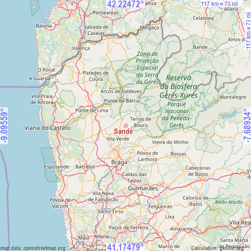
Sande GPS coordinates[2]
41° 42' 6.84" North, 8° 23' 32.856" West
| Map corner | latitude | longitude |
|---|---|---|
| Upper-left | 42.22472°, | -9.09559° |
| Center: | 41.7019°, | -8.39246° |
| Lower-right: | 41.17479°, | -7.68934° |
| Map W x H: | 116.7×116.7 km | = 72.5×72.5mi |
| max Lat: | 42.11337° ⇑2.6% North |
| Sande: | 41.7019° |
| min Lat: | ⇓97.4% South 32.6448° |
| min Long | Sande | max Long |
| -31.17847° | -8.39246° | -6.27308° |
| W 63.5%⇐ | ⇒36.5% E |
Elevation
Elevation of Sande is 195 m = 640 ft, and this is 18 m = 59 ft above average elevation for this country.
| Max E: |
1008 m = 3307 ft | 31.2% |
| Sande | 195 m 640 ft | |
| Avg. | 177 m = 581 ft | |
Min E: |
-128 m = -420 ft | 68.8% |
See also: Portugal elevation on elevation.city.
Geographical zone
Sande is located in North temperate zone (between Tropic of Cancer and the Arctic Circle). Distance of this Northern Tropic circle is 2030.9 km =1261.9 mi to South.| Distance of | km | miles | from Sande |
|---|---|---|---|
| North Pole | 5370.2 | 3336.9 | to North |
| Arctic Circle | 2764.4 | 1717.7 | to North |
| Tropic Cancer | 2030.9 | 1261.9 | to South |
| Equator | 4636.8 | 2881.2 | to South |


Nearby cities:
15 places around Sande: (largest is in red/bold)
• Aboim da Nóbrega
5.2 km =3.2 mi,  0°
0°
• Adaúfe
12.7 km =7.9 mi,  182°
182°
• Amares
8.6 km =5.3 mi,  156°
156°
• Arcos de Valdevez
16.2 km =10.1 mi,  352°
352°
• Caldelas
3.6 km =2.2 mi,  165°
165°
• Ferreiros
8.2 km =5.1 mi, 163°
• Frossos
15.9 km =9.9 mi,  197°
197°
• Goães
8.4 km =5.2 mi,  124°
124°
• Lago
9.1 km =5.7 mi,  190°
190°
• Merelim
14.3 km =8.9 mi,  205°
205°
• Ponte da Barca
11.6 km =7.2 mi, 350°
• Prado
12.5 km =7.8 mi, 207°
• Rendufe
8.2 km =5.1 mi, 189°
• Terras de Bouro
7.2 km =4.5 mi,  75°
75°
• Vila Verde
7.1 km =4.4 mi, 211°
Sources, notices
• [Note1] Compared only with cities in Portugal existing in our database
• [Src1] Map data: © OpenStreetMap contributors (CC-BY-SA)
• [Src2] Other city data from geonames.org with taken over terms of usage.
• [Src3] Geographical zone / Annual Mean Temperature by Robert A. Rohde @ Wikipedia
