Aboim da Nóbrega geodata
Aboim da Nóbrega (Braga) is a populated place; located in Portugal in Europe/Lisbon (GMT+1) time zone. With population of 987 people, there are 754 cities with bigger population in this country. Compared to other cities in Portugal, 98% of cities are located further ↓South; 63.6% of cities are located further ←West and 87.3% of cities have lower elevation than Aboim da Nóbrega. Note1


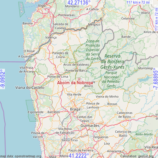
Aboim da Nóbrega GPS coordinates[2]
41° 44' 56.112" North, 8° 23' 31.488" West
| Map corner | latitude | longitude |
|---|---|---|
| Upper-left | 42.27136°, | -9.0952° |
| Center: | 41.74892°, | -8.39208° |
| Lower-right: | 41.2222°, | -7.68895° |
| Map W x H: | 116.7×116.7 km | = 72.5×72.5mi |
| max Lat: | 42.11337° ⇑2% North |
| Aboim da Nóbrega: | 41.74892° |
| min Lat: | ⇓98% South 32.6448° |
| min Long | Aboim da Nóbre | max Long |
| -31.17847° | -8.39208° | -6.27308° |
| W 63.6%⇐ | ⇒36.4% E |
Elevation
Elevation of Aboim da Nóbrega is 400 m = 1312 ft, and this is 223 m = 732 ft above average elevation for this country.
| Max E: |
1008 m = 3307 ft | 12.7% |
| Aboim da Nóbrega | 400 m 1312 ft | |
| Avg. | 177 m = 581 ft | |
Min E: |
-128 m = -420 ft | 87.3% |
See also: Portugal elevation on elevation.city.
Geographical zone
Aboim da Nóbrega is located in North temperate zone (between Tropic of Cancer and the Arctic Circle). Distance of this Northern Tropic circle is 2036.1 km =1265.2 mi to South.| Distance of | km | miles | from Aboim da Nóbrega |
|---|---|---|---|
| North Pole | 5365 | 3333.7 | to North |
| Arctic Circle | 2759.1 | 1714.4 | to North |
| Tropic Cancer | 2036.1 | 1265.2 | to South |
| Equator | 4642 | 2884.4 | to South |


Nearby cities:
15 places around Aboim da Nóbrega: (largest is in red/bold)
• Adaúfe
18 km =11.2 mi,  181°
181°
• Amares
13.6 km =8.5 mi,  165°
165°
• Arcos de Valdevez
11.1 km =6.9 mi,  348°
348°
• Caldelas
8.7 km =5.4 mi, 174°
• Ferreiros
13.3 km =8.3 mi, 169°
• Goães
12.1 km =7.5 mi,  145°
145°
• Lago
14.3 km =8.9 mi,  186°
186°
• Mozelos
13.2 km =8.2 mi,  357°
357°
• Ponte da Barca
6.5 km =4 mi,  342°
342°
• Ponte de Lima
16 km =9.9 mi,  277°
277°
• Prado
17.3 km =10.7 mi,  199°
199°
• Rendufe
13.4 km =8.3 mi, 185°
• Sande
5.2 km =3.2 mi, 180°
• Terras de Bouro
7.7 km =4.8 mi,  116°
116°
• Vila Verde
11.9 km =7.4 mi, 198°
Sources, notices
• [Note1] Compared only with cities in Portugal existing in our database
• [Src1] Map data: © OpenStreetMap contributors (CC-BY-SA)
• [Src2] Other city data from geonames.org with taken over terms of usage.
• [Src3] Geographical zone / Annual Mean Temperature by Robert A. Rohde @ Wikipedia
