Lago geodata
Lago (Braga) is a populated place; located in Portugal in Europe/Lisbon (GMT+1) time zone. With population of 1,910 people, there are 657 cities with bigger population in this country. Compared to other cities in Portugal, 96.2% of cities are located further ↓South; 61.7% of cities are located further ←West and 62.1% of cities have higher elevation than Lago. Note1


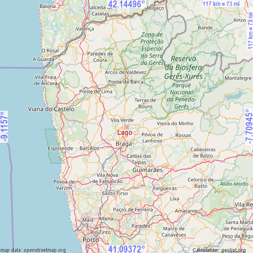
Lago GPS coordinates[2]
41° 37' 17.328" North, 8° 24' 45.288" West
| Map corner | latitude | longitude |
|---|---|---|
| Upper-left | 42.14496°, | -9.1157° |
| Center: | 41.62148°, | -8.41258° |
| Lower-right: | 41.09372°, | -7.70945° |
| Map W x H: | 116.9×116.9 km | = 72.6×72.6mi |
| max Lat: | 42.11337° ⇑3.8% North |
| Lago: | 41.62148° |
| min Lat: | ⇓96.2% South 32.6448° |
| min Long | Lago | max Long |
| -31.17847° | -8.41258° | -6.27308° |
| W 61.7%⇐ | ⇒38.3% E |
Elevation
Elevation of Lago is 72 m = 236 ft, and this is 105 m = 344 ft below average elevation for this country.
| Max E: |
1008 m = 3307 ft | 62.1% |
| Avg. | 177 m = 581 ft | |
| Lago | 72 m = 236 ft | |
Min E: |
-128 m = -420 ft | 37.9% |
See also: Portugal elevation on elevation.city.
Geographical zone
Lago is located in North temperate zone (between Tropic of Cancer and the Arctic Circle). Distance of this Northern Tropic circle is 2022 km =1256.4 mi to South.| Distance of | km | miles | from Lago |
|---|---|---|---|
| North Pole | 5379.2 | 3342.5 | to North |
| Arctic Circle | 2773.3 | 1723.2 | to North |
| Tropic Cancer | 2022 | 1256.4 | to South |
| Equator | 4627.9 | 2875.6 | to South |


Nearby cities:
15 places around Lago: (largest is in red/bold)
• Adaúfe
4 km =2.5 mi,  162°
162°
• Amares
5.2 km =3.2 mi,  78°
78°
• Braga
7.9 km =4.9 mi,  184°
184°
• Caldelas
6.1 km =3.8 mi,  25°
25°
• Ferreiros
4.2 km =2.6 mi, 75°
• Frossos
7 km =4.3 mi,  207°
207°
• Gondizalves
9.6 km =6 mi,  201°
201°
• Goães
9.5 km =5.9 mi,  64°
64°
• Merelim
5.9 km =3.7 mi,  227°
227°
• Prado
4.7 km =2.9 mi,  243°
243°
• Real
7.5 km =4.7 mi, 200°
• Rendufe
0.9 km =0.6 mi,  21°
21°
• Sande
9.1 km =5.7 mi,  10°
10°
• Semelhe
8.6 km =5.3 mi, 209°
• Vila Verde
3.5 km =2.2 mi,  324°
324°
Sources, notices
• [Note1] Compared only with cities in Portugal existing in our database
• [Src1] Map data: © OpenStreetMap contributors (CC-BY-SA)
• [Src2] Other city data from geonames.org with taken over terms of usage.
• [Src3] Geographical zone / Annual Mean Temperature by Robert A. Rohde @ Wikipedia
