Mira geodata
Mira (Coimbra) is a seat of a second-order administrative division; located in Portugal in Europe/Lisbon (GMT+1) time zone. With population of 7,682 people, there are 295 cities with bigger population in this country. Compared to other cities in Portugal, 60.2% of cities are located further ↓South; 65.3% of cities are located further →East and 80.9% of cities have higher elevation than Mira. Note1


Mira GPS coordinates[2]
40° 25' 44.112" North, 8° 44' 14.856" West
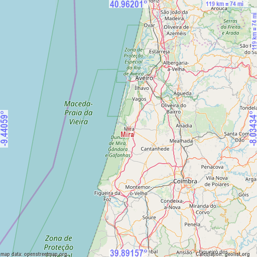
| Map corner | latitude | longitude |
|---|---|---|
| Upper-left | 40.96201°, | -9.44059° |
| Center: | 40.42892°, | -8.73746° |
| Lower-right: | 39.89157°, | -8.03434° |
| Map W x H: | 119×119 km | = 73.9×73.9mi |
| max Lat: | 42.11337° ⇑39.8% North |
| Mira: | 40.42892° |
| min Lat: | ⇓60.2% South 32.6448° |
| min Long | Mira | max Long |
| -31.17847° | -8.73746° | -6.27308° |
| W 34.7%⇐ | ⇒65.3% E |
Elevation
Elevation of Mira is 32 m = 105 ft, and this is 145 m = 476 ft below average elevation for this country.
| Max E: |
1008 m = 3307 ft | 80.9% |
| Avg. | 177 m = 581 ft | |
| Mira | 32 m = 105 ft | |
Min E: |
-128 m = -420 ft | 19.1% |
See also: Portugal elevation on elevation.city.
Geographical zone
Mira is located in North temperate zone (between Tropic of Cancer and the Arctic Circle). Distance of this Northern Tropic circle is 1889.4 km =1174 mi to South.| Distance of | km | miles | from Mira |
|---|---|---|---|
| North Pole | 5511.8 | 3424.9 | to North |
| Arctic Circle | 2905.9 | 1805.6 | to North |
| Tropic Cancer | 1889.4 | 1174 | to South |
| Equator | 4495.3 | 2793.2 | to South |


Nearby cities:
15 places around Mira: (largest is in red/bold)
• Aradas
22.8 km =14.2 mi,  20°
20°
• Arazede
17.5 km =10.9 mi,  154°
154°
• Arcos
25.1 km =15.6 mi,  85°
85°
• Aveiro
25.2 km =15.7 mi, 17°
• Cantanhede
15.2 km =9.4 mi,  126°
126°
• Gafanha da Encarnação
21 km =13 mi,  1°
1°
• Gafanha da Nazaré
23.1 km =14.4 mi,  5°
5°
• Mealhada
25 km =15.5 mi,  103°
103°
• Oiã
21 km =13 mi,  53°
53°
• Oliveira do Bairro
22.7 km =14.1 mi,  65°
65°
• Oliveirinha
23.3 km =14.5 mi,  31°
31°
• Sangalhos
23.6 km =14.7 mi, 74°
• Tocha
13 km =8.1 mi,  185°
185°
• Vagos
14.9 km =9.3 mi, 18°
• Ílhavo
20.1 km =12.5 mi, 16°
Sources, notices
• [Note1] Compared only with cities in Portugal existing in our database
• [Src1] Map data: © OpenStreetMap contributors (CC-BY-SA)
• [Src2] Other city data from geonames.org with taken over terms of usage.
• [Src3] Geographical zone / Annual Mean Temperature by Robert A. Rohde @ Wikipedia
