Meadela geodata
Meadela (Viana do Castelo) is a populated place; located in Portugal in Europe/Lisbon (GMT+1) time zone. With population of 9,981 people, there are 218 cities with bigger population in this country. Compared to other cities in Portugal, 97.5% of cities are located further ↓South; 68.6% of cities are located further →East and 98% of cities have higher elevation than Meadela. Note1


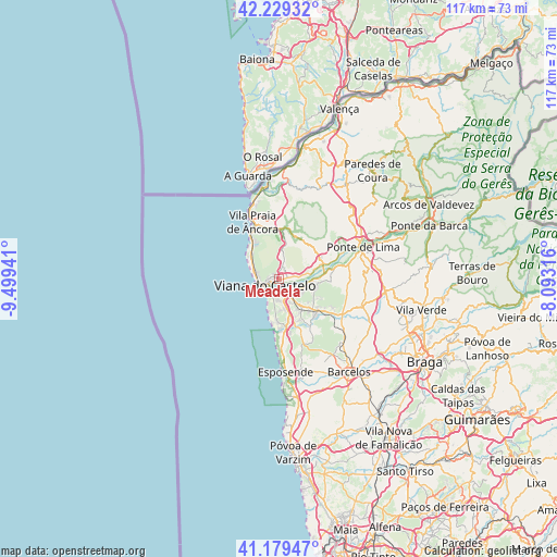
Meadela GPS coordinates[2]
41° 42' 23.544" North, 8° 47' 46.608" West
| Map corner | latitude | longitude |
|---|---|---|
| Upper-left | 42.22932°, | -9.49941° |
| Center: | 41.70654°, | -8.79628° |
| Lower-right: | 41.17947°, | -8.09316° |
| Map W x H: | 116.7×116.7 km | = 72.5×72.5mi |
| max Lat: | 42.11337° ⇑2.5% North |
| Meadela: | 41.70654° |
| min Lat: | ⇓97.5% South 32.6448° |
| min Long | Meadela | max Long |
| -31.17847° | -8.79628° | -6.27308° |
| W 31.4%⇐ | ⇒68.6% E |
Elevation
Elevation of Meadela is 6 m = 20 ft, and this is 171 m = 561 ft below average elevation for this country.
| Max E: |
1008 m = 3307 ft | 98% |
| Avg. | 177 m = 581 ft | |
| Meadela | 6 m = 20 ft | |
Min E: |
-128 m = -420 ft | 2% |
See also: Portugal elevation on elevation.city.
Geographical zone
Meadela is located in North temperate zone (between Tropic of Cancer and the Arctic Circle). Distance of this Northern Tropic circle is 2031.4 km =1262.3 mi to South.| Distance of | km | miles | from Meadela |
|---|---|---|---|
| North Pole | 5369.7 | 3336.6 | to North |
| Arctic Circle | 2763.8 | 1717.3 | to North |
| Tropic Cancer | 2031.4 | 1262.3 | to South |
| Equator | 4637.3 | 2881.5 | to South |


Nearby cities:
15 places around Meadela: (largest is in red/bold)
• Apúlia e Fão
21.7 km =13.5 mi,  174°
174°
• Areosa
5.2 km =3.2 mi,  283°
283°
• Barcelos
24.4 km =15.2 mi,  142°
142°
• Darque
3.6 km =2.2 mi, 136°
• Esposende
19 km =11.8 mi,  176°
176°
• Fornelos
23.2 km =14.4 mi,  154°
154°
• Gandra
20.7 km =12.9 mi, 172°
• Marinhas
16.4 km =10.2 mi, 176°
• Mariz
22.4 km =13.9 mi, 152°
• Perelhal
21.5 km =13.4 mi,  155°
155°
• Ponte de Lima
18.9 km =11.7 mi,  69°
69°
• Viana do Castelo
3.4 km =2.1 mi,  244°
244°
• Vila Cova
18.5 km =11.5 mi, 159°
• Vila Frescainha
22.8 km =14.2 mi, 145°
• Vila Praia de Âncora
12.5 km =7.8 mi,  338°
338°
Sources, notices
• [Note1] Compared only with cities in Portugal existing in our database
• [Src1] Map data: © OpenStreetMap contributors (CC-BY-SA)
• [Src2] Other city data from geonames.org with taken over terms of usage.
• [Src3] Geographical zone / Annual Mean Temperature by Robert A. Rohde @ Wikipedia
