Gulpilhares geodata
Gulpilhares (Porto) is a populated place; located in Portugal in Europe/Lisbon (GMT+1) time zone. With population of 10,660 people, there are 205 cities with bigger population in this country. Compared to other cities in Portugal, 73.4% of cities are located further ↓South; 56.3% of cities are located further →East and 58.3% of cities have higher elevation than Gulpilhares. Note1


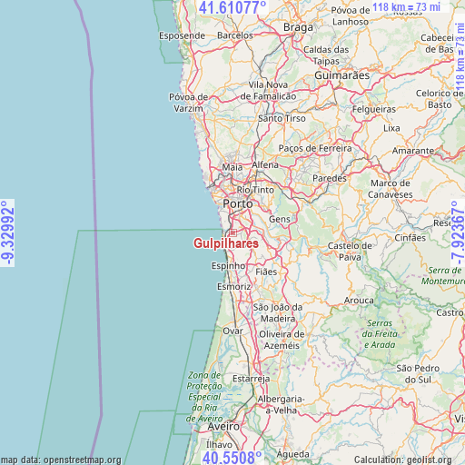
Gulpilhares GPS coordinates[2]
41° 4' 58.512" North, 8° 37' 36.444" West
| Map corner | latitude | longitude |
|---|---|---|
| Upper-left | 41.61077°, | -9.32992° |
| Center: | 41.08292°, | -8.62679° |
| Lower-right: | 40.5508°, | -7.92367° |
| Map W x H: | 117.9×117.9 km | = 73.3×73.3mi |
| max Lat: | 42.11337° ⇑26.6% North |
| Gulpilhares: | 41.08292° |
| min Lat: | ⇓73.4% South 32.6448° |
| min Long | Gulpilhares | max Long |
| -31.17847° | -8.62679° | -6.27308° |
| W 43.7%⇐ | ⇒56.3% E |
Elevation
Elevation of Gulpilhares is 83 m = 272 ft, and this is 94 m = 308 ft below average elevation for this country.
| Max E: |
1008 m = 3307 ft | 58.3% |
| Avg. | 177 m = 581 ft | |
| Gulpilhares | 83 m = 272 ft | |
Min E: |
-128 m = -420 ft | 41.7% |
See also: Portugal elevation on elevation.city.
Geographical zone
Gulpilhares is located in North temperate zone (between Tropic of Cancer and the Arctic Circle). Distance of this Northern Tropic circle is 1962.1 km =1219.2 mi to South.| Distance of | km | miles | from Gulpilhares |
|---|---|---|---|
| North Pole | 5439.1 | 3379.7 | to North |
| Arctic Circle | 2833.2 | 1760.5 | to North |
| Tropic Cancer | 1962.1 | 1219.2 | to South |
| Equator | 4568 | 2838.4 | to South |


Nearby cities:
15 places around Gulpilhares: (largest is in red/bold)
• Arcozelo
2.4 km =1.5 mi,  190°
190°
• Avintes
6.9 km =4.3 mi,  66°
66°
• Azenha
0.7 km =0.4 mi,  166°
166°
• Canelas
2.2 km =1.4 mi,  88°
88°
• Canidelo
4.8 km =3 mi,  339°
339°
• Grijó
7.2 km =4.5 mi,  147°
147°
• Oliveira do Douro
5.8 km =3.6 mi,  37°
37°
• Perozinho
4 km =2.5 mi,  119°
119°
• Sermonde
5.3 km =3.3 mi,  138°
138°
• Serzedo
3.7 km =2.3 mi, 165°
• São Félix da Marinha
5.3 km =3.3 mi,  176°
176°
• Vila Nova da Telha
1.8 km =1.1 mi,  224°
224°
• Vila Nova de Gaia
4.7 km =2.9 mi,  14°
14°
• Vilar de Andorinho
4.2 km =2.6 mi,  53°
53°
• Vilar do Paraíso
0.9 km =0.6 mi,  32°
32°
Sources, notices
• [Note1] Compared only with cities in Portugal existing in our database
• [Src1] Map data: © OpenStreetMap contributors (CC-BY-SA)
• [Src2] Other city data from geonames.org with taken over terms of usage.
• [Src3] Geographical zone / Annual Mean Temperature by Robert A. Rohde @ Wikipedia
