Campo geodata
Campo (Viseu) is a populated place; located in Portugal in Europe/Lisbon (GMT+1) time zone. With population of 4,551 people, there are 466 cities with bigger population in this country. Compared to other cities in Portugal, 64.7% of cities are located further ↓South; 81.9% of cities are located further ←West and 94.9% of cities have lower elevation than Campo. Note1


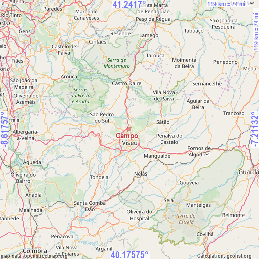
Campo GPS coordinates[2]
40° 42' 39.096" North, 7° 54' 52.02" West
| Map corner | latitude | longitude |
|---|---|---|
| Upper-left | 41.2417°, | -8.61757° |
| Center: | 40.71086°, | -7.91445° |
| Lower-right: | 40.17575°, | -7.21132° |
| Map W x H: | 118.5×118.5 km | = 73.6×73.6mi |
| max Lat: | 42.11337° ⇑35.3% North |
| Campo: | 40.71086° |
| min Lat: | ⇓64.7% South 32.6448° |
| min Long | Campo | max Long |
| -31.17847° | -7.91445° | -6.27308° |
| W 81.9%⇐ | ⇒18.1% E |
Elevation
Elevation of Campo is 591 m = 1939 ft, and this is 414 m = 1358 ft above average elevation for this country.
| Max E: |
1008 m = 3307 ft | 5.1% |
| Campo | 591 m 1939 ft | |
| Avg. | 177 m = 581 ft | |
Min E: |
-128 m = -420 ft | 94.9% |
See also: Portugal elevation on elevation.city.
Geographical zone
Campo is located in North temperate zone (between Tropic of Cancer and the Arctic Circle). Distance of this Northern Tropic circle is 1920.7 km =1193.5 mi to South.| Distance of | km | miles | from Campo |
|---|---|---|---|
| North Pole | 5480.4 | 3405.4 | to North |
| Arctic Circle | 2874.6 | 1786.2 | to North |
| Tropic Cancer | 1920.7 | 1193.5 | to South |
| Equator | 4526.6 | 2812.7 | to South |


Nearby cities:
15 places around Campo: (largest is in red/bold)
• Abraveses
3.3 km =2.1 mi,  189°
189°
• Campo de Besteiros
25.3 km =15.7 mi,  227°
227°
• Canas de Senhorim
23.5 km =14.6 mi,  176°
176°
• Castro Daire
20.9 km =13 mi,  355°
355°
• Mangualde
17.5 km =10.9 mi,  132°
132°
• Mesquitela
19.9 km =12.4 mi, 134°
• Nelas
20.6 km =12.8 mi,  165°
165°
• Oliveira de Frades
22.1 km =13.7 mi,  276°
276°
• Parada de Gonta
15.6 km =9.7 mi,  205°
205°
• Rio de Loba
5.9 km =3.7 mi,  148°
148°
• Sátão
15.7 km =9.8 mi,  77°
77°
• São Pedro do Sul
14.2 km =8.8 mi,  290°
290°
• Vila Nova de Paiva
22.3 km =13.9 mi,  44°
44°
• Viseu
5.6 km =3.5 mi, 175°
• Vouzela
16.8 km =10.4 mi,  274°
274°
Sources, notices
• [Note1] Compared only with cities in Portugal existing in our database
• [Src1] Map data: © OpenStreetMap contributors (CC-BY-SA)
• [Src2] Other city data from geonames.org with taken over terms of usage.
• [Src3] Geographical zone / Annual Mean Temperature by Robert A. Rohde @ Wikipedia
