Apúlia geodata
Apúlia (Braga) is a populated place; located in Portugal in Europe/Lisbon (GMT+1) time zone. With population of 4,394 people, there are 484 cities with bigger population in this country. Compared to other cities in Portugal, 91.6% of cities are located further ↓South; 66.3% of cities are located further →East and 95% of cities have higher elevation than Apúlia. Note1


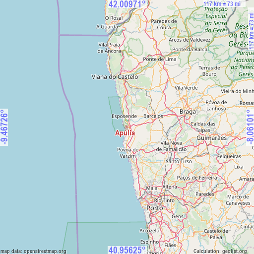
Apúlia GPS coordinates[2]
41° 29' 6.432" North, 8° 45' 50.868" West
| Map corner | latitude | longitude |
|---|---|---|
| Upper-left | 42.00971°, | -9.46726° |
| Center: | 41.48512°, | -8.76413° |
| Lower-right: | 40.95625°, | -8.06101° |
| Map W x H: | 117.1×117.1 km | = 72.8×72.8mi |
| max Lat: | 42.11337° ⇑8.4% North |
| Apúlia: | 41.48512° |
| min Lat: | ⇓91.6% South 32.6448° |
| min Long | Apúlia | max Long |
| -31.17847° | -8.76413° | -6.27308° |
| W 33.7%⇐ | ⇒66.3% E |
Elevation
Elevation of Apúlia is 10 m = 33 ft, and this is 167 m = 548 ft below average elevation for this country.
| Max E: |
1008 m = 3307 ft | 95% |
| Avg. | 177 m = 581 ft | |
| Apúlia | 10 m = 33 ft | |
Min E: |
-128 m = -420 ft | 5% |
See also: Portugal elevation on elevation.city.
Geographical zone
Apúlia is located in North temperate zone (between Tropic of Cancer and the Arctic Circle). Distance of this Northern Tropic circle is 2006.8 km =1247 mi to South.| Distance of | km | miles | from Apúlia |
|---|---|---|---|
| North Pole | 5394.3 | 3351.9 | to North |
| Arctic Circle | 2788.5 | 1732.7 | to North |
| Tropic Cancer | 2006.8 | 1247 | to South |
| Equator | 4612.7 | 2866.2 | to South |


Nearby cities:
15 places around Apúlia: (largest is in red/bold)
• Aguçadoura
6.1 km =3.8 mi,  191°
191°
• Apúlia e Fão
3.1 km =1.9 mi,  346°
346°
• Barqueiros
2.8 km =1.7 mi,  76°
76°
• Cristelo
5.6 km =3.5 mi,  96°
96°
• Esposende
5.9 km =3.7 mi, 345°
• Estela
4.1 km =2.5 mi,  165°
165°
• Faria
7.7 km =4.8 mi,  91°
91°
• Fornelos
8.1 km =5 mi,  63°
63°
• Gandra
4.1 km =2.5 mi,  2°
2°
• Marinhas
8.4 km =5.2 mi, 349°
• Paradela
7.4 km =4.6 mi,  110°
110°
• Pedroso
8.3 km =5.2 mi, 171°
• Perelhal
8 km =5 mi,  50°
50°
• Vila Cova
8.3 km =5.2 mi,  28°
28°
• Vila Seca
6.8 km =4.2 mi, 75°
Sources, notices
• [Note1] Compared only with cities in Portugal existing in our database
• [Src1] Map data: © OpenStreetMap contributors (CC-BY-SA)
• [Src2] Other city data from geonames.org with taken over terms of usage.
• [Src3] Geographical zone / Annual Mean Temperature by Robert A. Rohde @ Wikipedia
