Alpendurada geodata
Alpendurada (Porto) is a populated place; located in Portugal in Europe/Lisbon (GMT+1) time zone. With population of 8,485 people, there are 265 cities with bigger population in this country. Compared to other cities in Portugal, 73.6% of cities are located further ↓South; 71.5% of cities are located further ←West and 72.5% of cities have lower elevation than Alpendurada. Note1


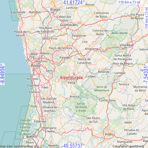
Alpendurada GPS coordinates[2]
41° 5' 21.984" North, 8° 14' 47.148" West
| Map corner | latitude | longitude |
|---|---|---|
| Upper-left | 41.61724°, | -8.94956° |
| Center: | 41.08944°, | -8.24643° |
| Lower-right: | 40.55737°, | -7.54331° |
| Map W x H: | 117.8×117.8 km | = 73.2×73.2mi |
| max Lat: | 42.11337° ⇑26.4% North |
| Alpendurada: | 41.08944° |
| min Lat: | ⇓73.6% South 32.6448° |
| min Long | Alpendurada | max Long |
| -31.17847° | -8.24643° | -6.27308° |
| W 71.5%⇐ | ⇒28.5% E |
Elevation
Elevation of Alpendurada is 216 m = 709 ft, and this is 39 m = 128 ft above average elevation for this country.
| Max E: |
1008 m = 3307 ft | 27.5% |
| Alpendurada | 216 m 709 ft | |
| Avg. | 177 m = 581 ft | |
Min E: |
-128 m = -420 ft | 72.5% |
See also: Portugal elevation on elevation.city.
Geographical zone
Alpendurada is located in North temperate zone (between Tropic of Cancer and the Arctic Circle). Distance of this Northern Tropic circle is 1962.8 km =1219.6 mi to South.| Distance of | km | miles | from Alpendurada |
|---|---|---|---|
| North Pole | 5438.3 | 3379.2 | to North |
| Arctic Circle | 2832.5 | 1760 | to North |
| Tropic Cancer | 1962.8 | 1219.6 | to South |
| Equator | 4568.7 | 2838.9 | to South |


Nearby cities:
15 places around Alpendurada: (largest is in red/bold)
• Arouca
17.7 km =11 mi,  179°
179°
• Baltar
16.5 km =10.3 mi,  314°
314°
• Castelo de Paiva
3.3 km =2.1 mi,  207°
207°
• Castelões de Cepeda
14.6 km =9.1 mi,  329°
329°
• Cinfães
13.3 km =8.3 mi,  98°
98°
• Madalena
15.9 km =9.9 mi, 332°
• Marco de Canavezes
13.3 km =8.3 mi,  37°
37°
• Melres
13.1 km =8.1 mi,  260°
260°
• Moreira
12.5 km =7.8 mi,  252°
252°
• Paredes
14.7 km =9.1 mi, 330°
• Penafiel
13.6 km =8.5 mi,  347°
347°
• Perafita
10.4 km =6.5 mi,  356°
356°
• Recarei
15.6 km =9.7 mi,  297°
297°
• Rio Mau
10.9 km =6.8 mi, 249°
• Santo Izidoro
16.1 km =10 mi,  32°
32°
Sources, notices
• [Note1] Compared only with cities in Portugal existing in our database
• [Src1] Map data: © OpenStreetMap contributors (CC-BY-SA)
• [Src2] Other city data from geonames.org with taken over terms of usage.
• [Src3] Geographical zone / Annual Mean Temperature by Robert A. Rohde @ Wikipedia
