Melres geodata
Melres (Porto) is a populated place; located in Portugal in Europe/Lisbon (GMT+1) time zone. With population of 10,328 people, there are 213 cities with bigger population in this country. Compared to other cities in Portugal, 72.7% of cities are located further ↓South; 62.9% of cities are located further ←West and 73.2% of cities have higher elevation than Melres. Note1


Melres GPS coordinates[2]
41° 4' 11.604" North, 8° 24' 3.276" West
| Map corner | latitude | longitude |
|---|---|---|
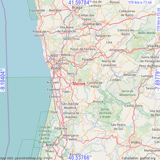
| Upper-left | 41.59784°, | -9.10404° |
| Center: | 41.06989°, | -8.40091° |
| Lower-right: | 40.53766°, | -7.69779° |
| Map W x H: | 117.9×117.9 km | = 73.3×73.3mi |
| max Lat: | 42.11337° ⇑27.3% North |
| Melres: | 41.06989° |
| min Lat: | ⇓72.7% South 32.6448° |
| min Long | Melres | max Long |
| -31.17847° | -8.40091° | -6.27308° |
| W 62.9%⇐ | ⇒37.1% E |
Elevation
Elevation of Melres is 44 m = 144 ft, and this is 133 m = 436 ft below average elevation for this country.
| Max E: |
1008 m = 3307 ft | 73.2% |
| Avg. | 177 m = 581 ft | |
| Melres | 44 m = 144 ft | |
Min E: |
-128 m = -420 ft | 26.8% |
See also: Portugal elevation on elevation.city.
Geographical zone
Melres is located in North temperate zone (between Tropic of Cancer and the Arctic Circle). Distance of this Northern Tropic circle is 1960.6 km =1218.3 mi to South.| Distance of | km | miles | from Melres |
|---|---|---|---|
| North Pole | 5440.5 | 3380.6 | to North |
| Arctic Circle | 2834.6 | 1761.3 | to North |
| Tropic Cancer | 1960.6 | 1218.3 | to South |
| Equator | 4566.5 | 2837.5 | to South |


Nearby cities:
15 places around Melres: (largest is in red/bold)
• Alpendurada
13.1 km =8.1 mi,  80°
80°
• Argoncilhe
12.6 km =7.8 mi,  246°
246°
• Avintes
13.3 km =8.3 mi,  288°
288°
• Baltar
13.7 km =8.5 mi,  4°
4°
• Castelo de Paiva
11.4 km =7.1 mi,  93°
93°
• Fiães
13.4 km =8.3 mi,  231°
231°
• Foz do Sousa
9 km =5.6 mi, 289°
• Jovim
10.9 km =6.8 mi, 294°
• Lobão
11.7 km =7.3 mi,  217°
217°
• Moreira
1.8 km =1.1 mi,  147°
147°
• Olival
12.2 km =7.6 mi,  259°
259°
• Recarei
9.3 km =5.8 mi,  354°
354°
• Rio Mau
3.1 km =1.9 mi,  120°
120°
• Sandim
9.7 km =6 mi, 246°
• São Pedro da Cova
11.7 km =7.3 mi,  314°
314°
Sources, notices
• [Note1] Compared only with cities in Portugal existing in our database
• [Src1] Map data: © OpenStreetMap contributors (CC-BY-SA)
• [Src2] Other city data from geonames.org with taken over terms of usage.
• [Src3] Geographical zone / Annual Mean Temperature by Robert A. Rohde @ Wikipedia
