Águeda geodata
Águeda (Aveiro) is a seat of a second-order administrative division; located in Portugal in Europe/Lisbon (GMT+1) time zone. With population of 11,941 people, there are 173 cities with bigger population in this country. Compared to other cities in Portugal, 62.4% of cities are located further ↓South; 59% of cities are located further ←West and 75.9% of cities have higher elevation than Águeda. Note1


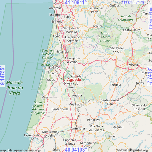
Águeda GPS coordinates[2]
40° 34' 37.92" North, 8° 26' 39.912" West
| Map corner | latitude | longitude |
|---|---|---|
| Upper-left | 41.10911°, | -9.14755° |
| Center: | 40.5772°, | -8.44442° |
| Lower-right: | 40.04103°, | -7.7413° |
| Map W x H: | 118.8×118.8 km | = 73.8×73.8mi |
| max Lat: | 42.11337° ⇑37.6% North |
| Águeda: | 40.5772° |
| min Lat: | ⇓62.4% South 32.6448° |
| min Long | Águeda | max Long |
| -31.17847° | -8.44442° | -6.27308° |
| W 59%⇐ | ⇒41% E |
Elevation
Elevation of Águeda is 39 m = 128 ft, and this is 138 m = 453 ft below average elevation for this country.
| Max E: |
1008 m = 3307 ft | 75.9% |
| Avg. | 177 m = 581 ft | |
| Águeda | 39 m = 128 ft | |
Min E: |
-128 m = -420 ft | 24.1% |
See also: Portugal elevation on elevation.city.
Geographical zone
Águeda is located in North temperate zone (between Tropic of Cancer and the Arctic Circle). Distance of this Northern Tropic circle is 1905.8 km =1184.2 mi to South.| Distance of | km | miles | from Águeda |
|---|---|---|---|
| North Pole | 5495.3 | 3414.6 | to North |
| Arctic Circle | 2889.4 | 1795.4 | to North |
| Tropic Cancer | 1905.8 | 1184.2 | to South |
| Equator | 4511.8 | 2803.5 | to South |


Nearby cities:
15 places around Águeda: (largest is in red/bold)
• Aguada de Cima
6.2 km =3.9 mi,  166°
166°
• Albergaria-a-Velha
13.2 km =8.2 mi,  346°
346°
• Anadia
15.5 km =9.6 mi,  176°
176°
• Aradas
17.4 km =10.8 mi,  286°
286°
• Arcos
14.4 km =8.9 mi, 179°
• Aveiro
18.5 km =11.5 mi, 293°
• Belazaima do Chão
8.3 km =5.2 mi,  126°
126°
• Eixo
11.9 km =7.4 mi,  297°
297°
• Esgueira
17.5 km =10.9 mi, 297°
• Oiã
8.8 km =5.5 mi,  244°
244°
• Oliveira do Bairro
8.1 km =5 mi,  210°
210°
• Oliveirinha
12.9 km =8 mi,  284°
284°
• Sangalhos
10.3 km =6.4 mi,  191°
191°
• Sever do Vouga
18.7 km =11.6 mi,  20°
20°
• Valongo
4.4 km =2.7 mi, 353°
Sources, notices
• [Note1] Compared only with cities in Portugal existing in our database
• [Src1] Map data: © OpenStreetMap contributors (CC-BY-SA)
• [Src2] Other city data from geonames.org with taken over terms of usage.
• [Src3] Geographical zone / Annual Mean Temperature by Robert A. Rohde @ Wikipedia
