Santa Cruz das Flores geodata
Santa Cruz das Flores (Azores) is a populated place; located in Portugal in Atlantic/Azores (GMT+0) time zone. With population of 1,725 people, there are 672 cities with bigger population in this country. Compared to other cities in Portugal, 54.4% of cities are located further ↑North; 99.9% of cities are located further →East and 82.9% of cities have higher elevation than Santa Cruz das Flores. Note1
Administrative division(s):
- Level 1: Azores
- Level 2: Santa Cruz Das Flores
- Level 3: Santa Cruz das Flores


Santa Cruz das Flores GPS coordinates[2]
39° 27' 28.152" North, 31° 7' 47.604" West
| Map corner | latitude | longitude |
|---|---|---|
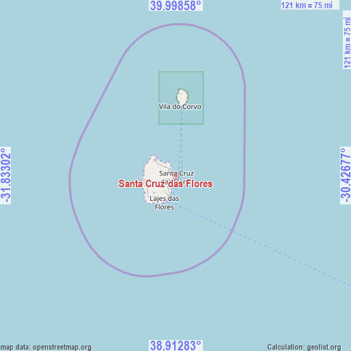
| Upper-left | 39.99858°, | -31.83302° |
| Center: | 39.45782°, | -31.12989° |
| Lower-right: | 38.91283°, | -30.42677° |
| Map W x H: | 120.7×120.7 km | = 75×75mi |
| max Lat: | 42.11337° ⇑54.4% North |
| Santa Cruz das Flores: | 39.45782° |
| min Lat: | ⇓45.6% South 32.6448° |
| min Long | Santa Cruz das | max Long |
| -31.17847° | -31.12989° | -6.27308° |
| W 0.1%⇐ | ⇒99.9% E |
Elevation
Elevation of Santa Cruz das Flores is 27 m = 89 ft, and this is 150 m = 492 ft below average elevation for this country.
| Max E: |
1008 m = 3307 ft | 82.9% |
| Avg. | 177 m = 581 ft | |
| Santa Cruz das Flores | 27 m = 89 ft | |
Min E: |
-128 m = -420 ft | 17.1% |
See also: Portugal elevation on elevation.city.
Geographical zone
Santa Cruz das Flores is located in North temperate zone (between Tropic of Cancer and the Arctic Circle). Distance of this Northern Tropic circle is 1781.4 km =1106.9 mi to South.| Distance of | km | miles | from Santa Cruz das Flores |
|---|---|---|---|
| North Pole | 5619.8 | 3492 | to North |
| Arctic Circle | 3013.9 | 1872.8 | to North |
| Tropic Cancer | 1781.4 | 1106.9 | to South |
| Equator | 4387.3 | 2726.1 | to South |


Nearby cities:
15 places around Santa Cruz das Flores: (largest is in red/bold)
• Angústias
239.5 km =148.8 mi,  115°
115°
• Bandeiras
252.1 km =156.6 mi,  113°
113°
• Cais do Pico
264 km =164 mi, 113°
• Castelo Branco
233.3 km =145 mi, 116°
• Cedros
229.3 km =142.5 mi, 113°
• Horta
239.3 km =148.7 mi, 115°
• Lajes
275.5 km =171.2 mi, 115°
• Lajes das Flores
9.9 km =6.2 mi,  205°
205°
• Madalena
247.2 km =153.6 mi, 114°
• Ribeira Grande
234.6 km =145.8 mi, 116°
• Rosais
261.8 km =162.7 mi, 108°
• Santa Cruz da Graciosa
272.1 km =169.1 mi,  98°
98°
• São Roque do Pico
265.4 km =164.9 mi, 113°
• Urzelina
273.9 km =170.2 mi, 109°
• Velas
266.5 km =165.6 mi, 108°
Sources, notices
• [Note1] Compared only with cities in Portugal existing in our database
• [Src1] Map data: © OpenStreetMap contributors (CC-BY-SA)
• [Src2] Other city data from geonames.org with taken over terms of usage.
• [Src3] Geographical zone / Annual Mean Temperature by Robert A. Rohde @ Wikipedia
