Cedros geodata
Cedros (Azores) is a populated place; located in Portugal in Atlantic/Azores (GMT+0) time zone. With population of 907 people, there are 766 cities with bigger population in this country. Compared to other cities in Portugal, 78.6% of cities are located further ↑North; 99.5% of cities are located further →East and 55.1% of cities have higher elevation than Cedros. Note1


Cedros GPS coordinates[2]
38° 38' 7.836" North, 28° 41' 39.768" West
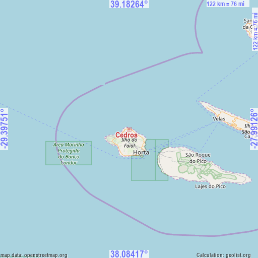
| Map corner | latitude | longitude |
|---|---|---|
| Upper-left | 39.18264°, | -29.39751° |
| Center: | 38.63551°, | -28.69438° |
| Lower-right: | 38.08417°, | -27.99126° |
| Map W x H: | 122.1×122.1 km | = 75.9×75.9mi |
| max Lat: | 42.11337° ⇑78.6% North |
| Cedros: | 38.63551° |
| min Lat: | ⇓21.4% South 32.6448° |
| min Long | Cedros | max Long |
| -31.17847° | -28.69438° | -6.27308° |
| W 0.5%⇐ | ⇒99.5% E |
Elevation
Elevation of Cedros is 92 m = 302 ft, and this is 85 m = 279 ft below average elevation for this country.
| Max E: |
1008 m = 3307 ft | 55.1% |
| Avg. | 177 m = 581 ft | |
| Cedros | 92 m = 302 ft | |
Min E: |
-128 m = -420 ft | 44.9% |
See also: Portugal elevation on elevation.city.
Geographical zone
Cedros is located in North temperate zone (between Tropic of Cancer and the Arctic Circle). Distance of this Northern Tropic circle is 1689.9 km =1050.1 mi to South.| Distance of | km | miles | from Cedros |
|---|---|---|---|
| North Pole | 5711.2 | 3548.8 | to North |
| Arctic Circle | 3105.3 | 1929.5 | to North |
| Tropic Cancer | 1689.9 | 1050.1 | to South |
| Equator | 4295.9 | 2669.3 | to South |


Nearby cities:
15 places around Cedros: (largest is in red/bold)
• Angústias
13.4 km =8.3 mi,  155°
155°
• Bandeiras
22.8 km =14.2 mi,  118°
118°
• Cais do Pico
34.7 km =21.6 mi,  110°
110°
• Calheta
58.9 km =36.6 mi,  93°
93°
• Castelo Branco
12.7 km =7.9 mi,  187°
187°
• Horta
12.4 km =7.7 mi,  151°
151°
• Lajes
46.8 km =29.1 mi, 124°
• Madalena
18.3 km =11.4 mi,  127°
127°
• Ribeira Grande
13.2 km =8.2 mi,  182°
182°
• Ribeira Seca
61.9 km =38.5 mi, 93°
• Rosais
39.6 km =24.6 mi,  76°
76°
• Santa Cruz da Graciosa
77.8 km =48.3 mi,  49°
49°
• São Roque do Pico
36.1 km =22.4 mi, 111°
• Urzelina
48.8 km =30.3 mi, 88°
• Velas
42.4 km =26.3 mi, 83°
Sources, notices
• [Note1] Compared only with cities in Portugal existing in our database
• [Src1] Map data: © OpenStreetMap contributors (CC-BY-SA)
• [Src2] Other city data from geonames.org with taken over terms of usage.
• [Src3] Geographical zone / Annual Mean Temperature by Robert A. Rohde @ Wikipedia
