General Delgado geodata
General Delgado (Itapúa) is a populated place; located in Paraguay in America/Asuncion (GMT-4) time zone. With population of 1,544 people, there are 124 cities with bigger population in this country. Compared to other cities in Paraguay, 92% of cities are located further ↑North; 53.1% of cities are located further ←West and 78.4% of cities have higher elevation than General Delgado. Note1


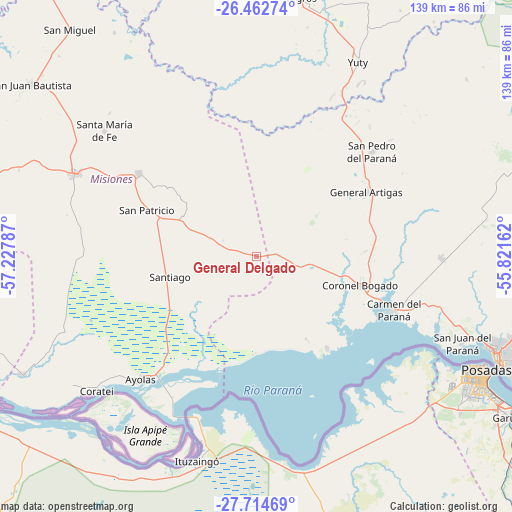
General Delgado GPS coordinates[2]
27° 5' 25.656" South, 56° 31' 29.064" West
| Map corner | latitude | longitude |
|---|---|---|
| Upper-left | -26.46274°, | -57.22787° |
| Center: | -27.09046°, | -56.52474° |
| Lower-right: | -27.71469°, | -55.82162° |
| Map W x H: | 139.2×139.2 km | = 86.5×86.5mi |
| max Lat: | -19.91667° ⇑92% North |
| General Delgado: | -27.09046° |
| min Lat: | ⇓8% South -27.38662° |
| min Long | General Delgado | max Long |
| -60.78333° | -56.52474° | -54.30694° |
| W 53.1%⇐ | ⇒46.9% E |
Elevation
Elevation of General Delgado is 111 m = 364 ft, and this is 58.7 m = 193 ft below average elevation for this country.
| Max E: |
658 m = 2159 ft | 78.4% |
| Avg. | 169.7 m = 557 ft | |
| General Delgado | 111 m = 364 ft | |
Min E: |
46 m = 151 ft | 21.6% |
See also: Paraguay elevation on elevation.city.
Geographical zone
General Delgado is located in South temperate zone (between Tropic of Capricorn and the Antarctic Circle). Distance of this Southern Tropic circle is 406.3 km =252.5 mi to North.| Distance of | km | miles | from General Delgado |
|---|---|---|---|
| Equator | 3012.2 | 1871.7 | to North |
| Tropic Capricorn | 406.3 | 252.5 | to North |
| Antarctic Circle | 4389 | 2727.2 | to South |
| South Pole | 6994.9 | 4346.4 | to South |


Nearby cities:
15 places around General Delgado: (largest is in red/bold)
• Capitán Miranda
72.7 km =45.2 mi,  99°
99°
• Carmen del Paraná
39.6 km =24.6 mi,  111°
111°
• Encarnación
70.3 km =43.7 mi, 112°
• Fram
64.6 km =40.1 mi,  79°
79°
• General Artigas
34.6 km =21.5 mi,  60°
60°
• Juan de Ayolas
45.8 km =28.5 mi,  224°
224°
• San Cosme y Damián
31.7 km =19.7 mi,  142°
142°
• San Juan del Paraná
60.1 km =37.3 mi, 112°
• San Patricio
32 km =19.9 mi,  295°
295°
• San Pedro del Paraná
42.7 km =26.5 mi,  47°
47°
• Santa María
53 km =32.9 mi,  310°
310°
• Santa Rosa Misiones
39.3 km =24.4 mi, 305°
• Santiago
24.8 km =15.4 mi,  256°
256°
• Yegros
72.3 km =44.9 mi,  9°
9°
• Yuty
59.7 km =37.1 mi,  27°
27°
Sources, notices
• [Note1] Compared only with cities in Paraguay existing in our database
• [Src1] Map data: © OpenStreetMap contributors (CC-BY-SA)
• [Src2] Other city data from geonames.org with taken over terms of usage.
• [Src3] Geographical zone / Annual Mean Temperature by Robert A. Rohde @ Wikipedia
