Juan de Ayolas geodata
Juan de Ayolas (Misiones) is a populated place; located in Paraguay in America/Asuncion (GMT-4) time zone. With population of 12,061 people, there are 26 cities with bigger population in this country. Compared to other cities in Paraguay, 100% of cities are located further ↑North; 57.4% of cities are located further →East and 89.5% of cities have higher elevation than Juan de Ayolas. Note1


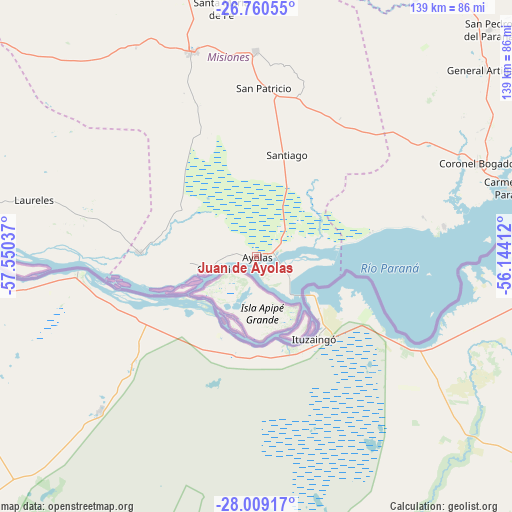
Juan de Ayolas GPS coordinates[2]
27° 23' 11.832" South, 56° 50' 50.064" West
| Map corner | latitude | longitude |
|---|---|---|
| Upper-left | -26.76055°, | -57.55037° |
| Center: | -27.38662°, | -56.84724° |
| Lower-right: | -28.00917°, | -56.14412° |
| Map W x H: | 138.8×138.8 km | = 86.2×86.2mi |
| max Lat: | -19.91667° ⇑100% North |
| Juan de Ayolas: | -27.38662° |
| min Lat: | ⇓0% South -27.38662° |
| min Long | Juan de Ayolas | max Long |
| -60.78333° | -56.84724° | -54.30694° |
| W 42.6%⇐ | ⇒57.4% E |
Elevation
Elevation of Juan de Ayolas is 81 m = 266 ft, and this is 88.7 m = 291 ft below average elevation for this country.
| Max E: |
658 m = 2159 ft | 89.5% |
| Avg. | 169.7 m = 557 ft | |
| Juan de Ayolas | 81 m = 266 ft | |
Min E: |
46 m = 151 ft | 10.5% |
See also: Paraguay elevation on elevation.city.
Geographical zone
Juan de Ayolas is located in South temperate zone (between Tropic of Capricorn and the Antarctic Circle). Distance of this Southern Tropic circle is 439.2 km =272.9 mi to North.| Distance of | km | miles | from Juan de Ayolas |
|---|---|---|---|
| Equator | 3045.1 | 1892.1 | to North |
| Tropic Capricorn | 439.2 | 272.9 | to North |
| Antarctic Circle | 4356.1 | 2706.8 | to South |
| South Pole | 6962 | 4326 | to South |


Nearby cities:
15 places around Juan de Ayolas: (largest is in red/bold)
• Carmen del Paraná
71 km =44.1 mi,  75°
75°
• Cerrito
78.6 km =48.8 mi,  273°
273°
• Encarnación
97 km =60.3 mi,  86°
86°
• General Artigas
79.7 km =49.5 mi,  50°
50°
• General Delgado
45.8 km =28.5 mi,  44°
44°
• Laureles
62.4 km =38.8 mi,  283°
283°
• San Cosme y Damián
51.6 km =32.1 mi, 81°
• San Juan Bautista
85.1 km =52.9 mi,  339°
339°
• San Juan del Paraná
87.6 km =54.4 mi, 83°
• San Miguel
100.6 km =62.5 mi,  348°
348°
• San Patricio
46.8 km =29.1 mi,  3°
3°
• San Pedro del Paraná
88.5 km =55 mi, 45°
• Santa María
67.6 km =42 mi, 352°
• Santa Rosa Misiones
55.5 km =34.5 mi,  359°
359°
• Santiago
28.2 km =17.5 mi,  16°
16°
Sources, notices
• [Note1] Compared only with cities in Paraguay existing in our database
• [Src1] Map data: © OpenStreetMap contributors (CC-BY-SA)
• [Src2] Other city data from geonames.org with taken over terms of usage.
• [Src3] Geographical zone / Annual Mean Temperature by Robert A. Rohde @ Wikipedia
