Tâmpa geodata
Tâmpa (Hunedoara) is a populated place; located in Romania in Europe/Bucharest (GMT+3) time zone. With population of 699 people, there are 5579 cities with bigger population in this country. Compared to other cities in Romania, 50.9% of cities are located further ↓South; 84.2% of cities are located further →East and 52.5% of cities have higher elevation than Tâmpa. Note1


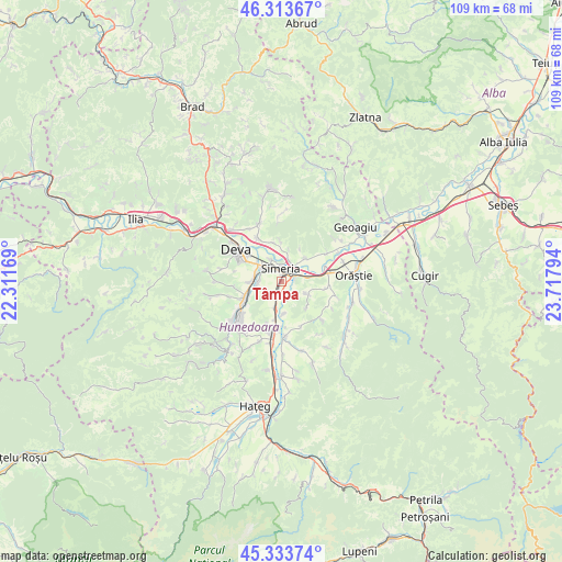
Tâmpa GPS coordinates[2]
45° 49' 33.096" North, 23° 0' 53.316" East
| Map corner | latitude | longitude |
|---|---|---|
| Upper-left | 46.31367°, | 22.31169° |
| Center: | 45.82586°, | 23.01481° |
| Lower-right: | 45.33374°, | 23.71794° |
| Map W x H: | 109×109 km | = 67.7×67.7mi |
| max Lat: | 48.23793° ⇑49.1% North |
| Tâmpa: | 45.82586° |
| min Lat: | ⇓50.9% South 43.65638° |
| min Long | Tâmpa | max Long |
| 20.31667° | 23.01481° | 29.65403° |
| W 15.8%⇐ | ⇒84.2% E |
Elevation
Elevation of Tâmpa is 199 m = 653 ft, and this is 55.9 m = 183 ft below average elevation for this country.
| Max E: |
1278 m = 4193 ft | 52.5% |
| Avg. | 254.9 m = 836 ft | |
| Tâmpa | 199 m = 653 ft | |
Min E: |
-2 m = -7 ft | 47.5% |
See also: Romania elevation on elevation.city.
Geographical zone
Tâmpa is located in North temperate zone (between Tropic of Cancer and the Arctic Circle). Distance of this North polar circle is 2305.8 km =1432.8 mi to North.| Distance of | km | miles | from Tâmpa |
|---|---|---|---|
| North Pole | 4911.7 | 3052 | to North |
| Arctic Circle | 2305.8 | 1432.8 | to North |
| Tropic Cancer | 2489.4 | 1546.8 | to South |
| Equator | 5095.4 | 3166.1 | to South |


Nearby cities:
15 places around Tâmpa: (largest is in red/bold)
• Banpotoc
8 km =5 mi,  357°
357°
• Batiz
5.4 km =3.4 mi,  190°
190°
• Bobâlna
10.5 km =6.5 mi,  58°
58°
• Băcia
2.9 km =1.8 mi,  177°
177°
• Cristur
5.6 km =3.5 mi,  274°
274°
• Călan
10.6 km =6.6 mi, 193°
• Hărău
9.7 km =6 mi,  328°
328°
• Mărtineşti
9.2 km =5.7 mi,  96°
96°
• Petreni
3.8 km =2.4 mi,  165°
165°
• Peștișu Mare
7.3 km =4.5 mi,  248°
248°
• Rapoltu Mare
6.1 km =3.8 mi,  41°
41°
• Simeria
2.7 km =1.7 mi,  3°
3°
• Sântandrei
4.6 km =2.9 mi,  305°
305°
• Sântuhalm
5.9 km =3.7 mi, 306°
• Turdaş
8.3 km =5.2 mi,  71°
71°
Sources, notices
• [Note1] Compared only with cities in Romania existing in our database
• [Src1] Map data: © OpenStreetMap contributors (CC-BY-SA)
• [Src2] Other city data from geonames.org with taken over terms of usage.
• [Src3] Geographical zone / Annual Mean Temperature by Robert A. Rohde @ Wikipedia
