Sântuhalm geodata
Sântuhalm (Hunedoara) is a section of populated place; located in Romania in Europe/Bucharest (GMT+3) time zone. With population of 549 people, there are 6588 cities with bigger population in this country. Compared to other cities in Romania, 51.7% of cities are located further ↓South; 85% of cities are located further →East and 53.9% of cities have higher elevation than Sântuhalm. Note1


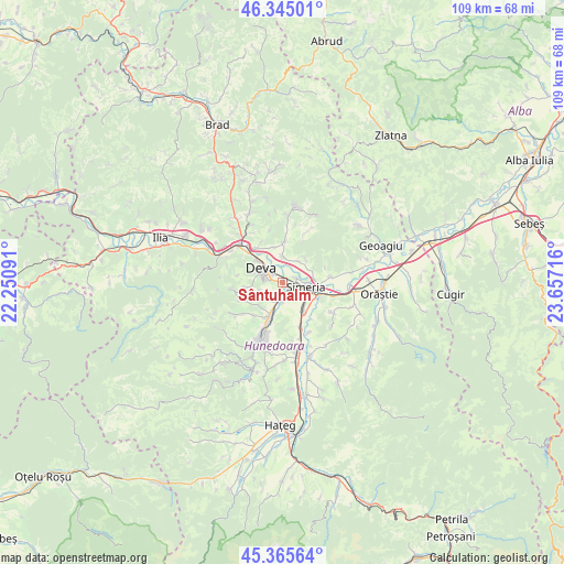
Sântuhalm GPS coordinates[2]
45° 51' 26.928" North, 22° 57' 14.508" East
| Map corner | latitude | longitude |
|---|---|---|
| Upper-left | 46.34501°, | 22.25091° |
| Center: | 45.85748°, | 22.95403° |
| Lower-right: | 45.36564°, | 23.65716° |
| Map W x H: | 108.9×108.9 km | = 67.7×67.7mi |
| max Lat: | 48.23793° ⇑48.3% North |
| Sântuhalm: | 45.85748° |
| min Lat: | ⇓51.7% South 43.65638° |
| min Long | Sântuhalm | max Long |
| 20.31667° | 22.95403° | 29.65403° |
| W 15%⇐ | ⇒85% E |
Elevation
Elevation of Sântuhalm is 192 m = 630 ft, and this is 62.9 m = 206 ft below average elevation for this country.
| Max E: |
1278 m = 4193 ft | 53.9% |
| Avg. | 254.9 m = 836 ft | |
| Sântuhalm | 192 m = 630 ft | |
Min E: |
-2 m = -7 ft | 46.1% |
See also: Romania elevation on elevation.city.
Geographical zone
Sântuhalm is located in North temperate zone (between Tropic of Cancer and the Arctic Circle). Distance of this North polar circle is 2302.3 km =1430.6 mi to North.| Distance of | km | miles | from Sântuhalm |
|---|---|---|---|
| North Pole | 4908.2 | 3049.8 | to North |
| Arctic Circle | 2302.3 | 1430.6 | to North |
| Tropic Cancer | 2493 | 1549.1 | to South |
| Equator | 5098.9 | 3168.3 | to South |


Nearby cities:
15 places around Sântuhalm: (largest is in red/bold)
• Banpotoc
6.3 km =3.9 mi,  44°
44°
• Bârsău
8.1 km =5 mi,  4°
4°
• Băcia
8 km =5 mi,  142°
142°
• Cristur
3.2 km =2 mi,  194°
194°
• Cârjiţi
9.4 km =5.8 mi,  264°
264°
• Deva
5.1 km =3.2 mi,  304°
304°
• Hărău
4.7 km =2.9 mi,  356°
356°
• Petreni
9.2 km =5.7 mi, 141°
• Peştişu Mic
8.4 km =5.2 mi,  220°
220°
• Peștișu Mare
6.5 km =4 mi,  198°
198°
• Rapoltu Mare
8.8 km =5.5 mi,  83°
83°
• Simeria
4.9 km =3 mi,  99°
99°
• Sântandrei
1.3 km =0.8 mi,  130°
130°
• Tâmpa
5.9 km =3.7 mi, 126°
• Şoimuş
7.8 km =4.8 mi,  327°
327°
Sources, notices
• [Note1] Compared only with cities in Romania existing in our database
• [Src1] Map data: © OpenStreetMap contributors (CC-BY-SA)
• [Src2] Other city data from geonames.org with taken over terms of usage.
• [Src3] Geographical zone / Annual Mean Temperature by Robert A. Rohde @ Wikipedia
