Simeria geodata
Simeria (Hunedoara) is a seat of a second-order administrative division; located in Romania in Europe/Bucharest (GMT+3) time zone. With population of 13,827 people, there are 139 cities with bigger population in this country. Compared to other cities in Romania, 51.4% of cities are located further ↓South; 84.2% of cities are located further →East and 52.3% of cities have higher elevation than Simeria. Note1


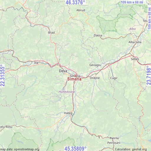
Simeria GPS coordinates[2]
45° 51' 0" North, 23° 1' 0.012" East
| Map corner | latitude | longitude |
|---|---|---|
| Upper-left | 46.3376°, | 22.31355° |
| Center: | 45.85°, | 23.01667° |
| Lower-right: | 45.35809°, | 23.7198° |
| Map W x H: | 108.9×108.9 km | = 67.7×67.7mi |
| max Lat: | 48.23793° ⇑48.6% North |
| Simeria: | 45.85° |
| min Lat: | ⇓51.4% South 43.65638° |
| min Long | Simeria | max Long |
| 20.31667° | 23.01667° | 29.65403° |
| W 15.8%⇐ | ⇒84.2% E |
Elevation
Elevation of Simeria is 200 m = 656 ft, and this is 54.9 m = 180 ft below average elevation for this country.
| Max E: |
1278 m = 4193 ft | 52.3% |
| Avg. | 254.9 m = 836 ft | |
| Simeria | 200 m = 656 ft | |
Min E: |
-2 m = -7 ft | 47.7% |
See also: Romania elevation on elevation.city.
Geographical zone
Simeria is located in North temperate zone (between Tropic of Cancer and the Arctic Circle). Distance of this North polar circle is 2303.1 km =1431.1 mi to North.| Distance of | km | miles | from Simeria |
|---|---|---|---|
| North Pole | 4909 | 3050.3 | to North |
| Arctic Circle | 2303.1 | 1431.1 | to North |
| Tropic Cancer | 2492.1 | 1548.5 | to South |
| Equator | 5098 | 3167.7 | to South |


Nearby cities:
15 places around Simeria: (largest is in red/bold)
• Banpotoc
5.3 km =3.3 mi,  355°
355°
• Batiz
8.1 km =5 mi,  187°
187°
• Bobâlna
9.2 km =5.7 mi,  72°
72°
• Băcia
5.6 km =3.5 mi,  180°
180°
• Cristur
6.1 km =3.8 mi,  248°
248°
• Deva
9.8 km =6.1 mi,  292°
292°
• Hărău
7.6 km =4.7 mi,  317°
317°
• Mărtineşti
9.8 km =6.1 mi,  112°
112°
• Petreni
6.4 km =4 mi,  172°
172°
• Peștișu Mare
8.8 km =5.5 mi,  232°
232°
• Rapoltu Mare
4.3 km =2.7 mi,  64°
64°
• Sântandrei
3.9 km =2.4 mi,  270°
270°
• Sântuhalm
4.9 km =3 mi,  279°
279°
• Turdaş
7.7 km =4.8 mi,  90°
90°
• Tâmpa
2.7 km =1.7 mi, 183°
Sources, notices
• [Note1] Compared only with cities in Romania existing in our database
• [Src1] Map data: © OpenStreetMap contributors (CC-BY-SA)
• [Src2] Other city data from geonames.org with taken over terms of usage.
• [Src3] Geographical zone / Annual Mean Temperature by Robert A. Rohde @ Wikipedia
