Telcișor geodata
Telcișor (Bistriţa-Năsăud) is a populated place; located in Romania in Europe/Bucharest (GMT+3) time zone. With population of 1,295 people, there are 3536 cities with bigger population in this country. Compared to other cities in Romania, 90.1% of cities are located further ↓South; 60.8% of cities are located further →East and 85.3% of cities have lower elevation than Telcișor. Note1


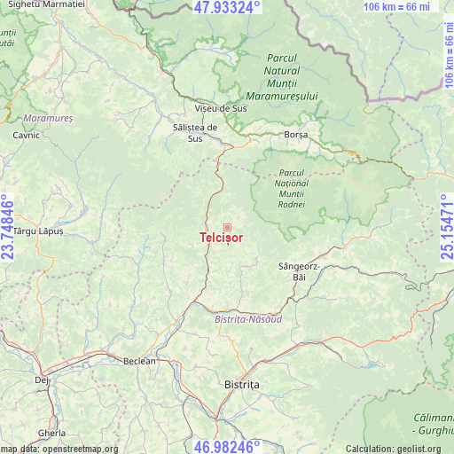
Telcișor GPS coordinates[2]
47° 27' 36" North, 24° 27' 5.688" East
| Map corner | latitude | longitude |
|---|---|---|
| Upper-left | 47.93324°, | 23.74846° |
| Center: | 47.46°, | 24.45158° |
| Lower-right: | 46.98246°, | 25.15471° |
| Map W x H: | 105.7×105.7 km | = 65.7×65.7mi |
| max Lat: | 48.23793° ⇑9.9% North |
| Telcișor: | 47.46° |
| min Lat: | ⇓90.1% South 43.65638° |
| min Long | Telcișor | max Long |
| 20.31667° | 24.45158° | 29.65403° |
| W 39.2%⇐ | ⇒60.8% E |
Elevation
Elevation of Telcișor is 449 m = 1473 ft, and this is 194.1 m = 637 ft above average elevation for this country.
| Max E: |
1278 m = 4193 ft | 14.7% |
| Telcișor | 449 m 1473 ft | |
| Avg. | 254.9 m = 836 ft | |
Min E: |
-2 m = -7 ft | 85.3% |
See also: Romania elevation on elevation.city.
Geographical zone
Telcișor is located in North temperate zone (between Tropic of Cancer and the Arctic Circle). Distance of this North polar circle is 2124.1 km =1319.9 mi to North.| Distance of | km | miles | from Telcișor |
|---|---|---|---|
| North Pole | 4730 | 2939.1 | to North |
| Arctic Circle | 2124.1 | 1319.9 | to North |
| Tropic Cancer | 2671.1 | 1659.7 | to South |
| Equator | 5277.1 | 3279 | to South |


Nearby cities:
15 places around Telcișor: (largest is in red/bold)
• Bichigiu
9.3 km =5.8 mi,  245°
245°
• Coşbuc
11.5 km =7.1 mi,  203°
203°
• Gersa I
13.8 km =8.6 mi,  177°
177°
• Parva
10 km =6.2 mi,  132°
132°
• Poienile Zagrei
16.7 km =10.4 mi,  241°
241°
• Rebra
16.3 km =10.1 mi,  167°
167°
• Romuli
8.3 km =5.2 mi,  350°
350°
• Runcu Salvei
16 km =9.9 mi,  216°
216°
• Salva
19.4 km =12.1 mi, 203°
• Suplai
14.6 km =9.1 mi,  259°
259°
• Sângeorz-Băi
19.5 km =12.1 mi,  121°
121°
• Săcel
19.3 km =12 mi,  355°
355°
• Telciu
4.9 km =3 mi,  232°
232°
• Valea Borcutului
17.9 km =11.1 mi, 122°
• Zagra
18.9 km =11.7 mi, 221°
Sources, notices
• [Note1] Compared only with cities in Romania existing in our database
• [Src1] Map data: © OpenStreetMap contributors (CC-BY-SA)
• [Src2] Other city data from geonames.org with taken over terms of usage.
• [Src3] Geographical zone / Annual Mean Temperature by Robert A. Rohde @ Wikipedia
