Bichigiu geodata
Bichigiu (Bistriţa-Năsăud) is a populated place; located in Romania in Europe/Bucharest (GMT+3) time zone. With population of 1,405 people, there are 3324 cities with bigger population in this country. Compared to other cities in Romania, 89.4% of cities are located further ↓South; 63% of cities are located further →East and 86.7% of cities have lower elevation than Bichigiu. Note1


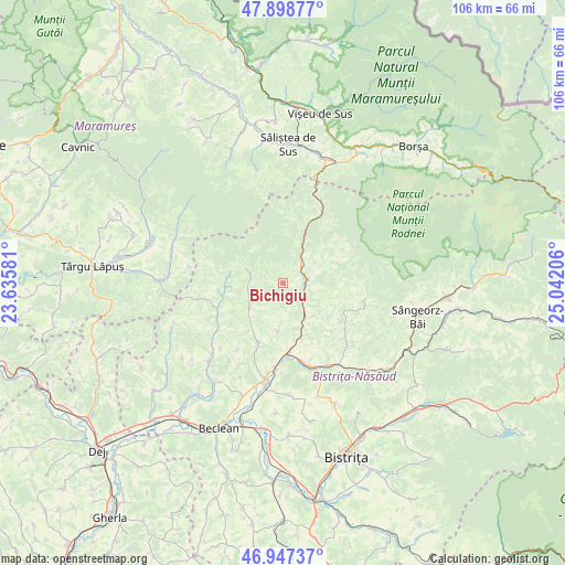
Bichigiu GPS coordinates[2]
47° 25' 30.792" North, 24° 20' 20.148" East
| Map corner | latitude | longitude |
|---|---|---|
| Upper-left | 47.89877°, | 23.63581° |
| Center: | 47.42522°, | 24.33893° |
| Lower-right: | 46.94737°, | 25.04206° |
| Map W x H: | 105.8×105.8 km | = 65.7×65.7mi |
| max Lat: | 48.23793° ⇑10.6% North |
| Bichigiu: | 47.42522° |
| min Lat: | ⇓89.4% South 43.65638° |
| min Long | Bichigiu | max Long |
| 20.31667° | 24.33893° | 29.65403° |
| W 37%⇐ | ⇒63% E |
Elevation
Elevation of Bichigiu is 465 m = 1526 ft, and this is 210.1 m = 689 ft above average elevation for this country.
| Max E: |
1278 m = 4193 ft | 13.3% |
| Bichigiu | 465 m 1526 ft | |
| Avg. | 254.9 m = 836 ft | |
Min E: |
-2 m = -7 ft | 86.7% |
See also: Romania elevation on elevation.city.
Geographical zone
Bichigiu is located in North temperate zone (between Tropic of Cancer and the Arctic Circle). Distance of this North polar circle is 2128 km =1322.3 mi to North.| Distance of | km | miles | from Bichigiu |
|---|---|---|---|
| North Pole | 4733.9 | 2941.5 | to North |
| Arctic Circle | 2128 | 1322.3 | to North |
| Tropic Cancer | 2667.3 | 1657.4 | to South |
| Equator | 5273.2 | 3276.6 | to South |


Nearby cities:
15 places around Bichigiu: (largest is in red/bold)
• Agrieș
15.6 km =9.7 mi,  259°
259°
• Borleasa
15 km =9.3 mi,  234°
234°
• Coşbuc
7.7 km =4.8 mi,  149°
149°
• Gersa I
13.5 km =8.4 mi,  137°
137°
• Perișor
14.9 km =9.3 mi,  214°
214°
• Poienile Zagrei
7.5 km =4.7 mi,  235°
235°
• Romuli
14 km =8.7 mi,  30°
30°
• Runcu Salvei
9.1 km =5.7 mi,  186°
186°
• Răpănaşu
12.6 km =7.8 mi,  248°
248°
• Salva
13.9 km =8.6 mi,  176°
176°
• Suplai
6.1 km =3.8 mi,  282°
282°
• Telciu
4.7 km =2.9 mi,  78°
78°
• Telcișor
9.3 km =5.8 mi,  65°
65°
• Târlişua
12.6 km =7.8 mi, 248°
• Zagra
11 km =6.8 mi,  202°
202°
Sources, notices
• [Note1] Compared only with cities in Romania existing in our database
• [Src1] Map data: © OpenStreetMap contributors (CC-BY-SA)
• [Src2] Other city data from geonames.org with taken over terms of usage.
• [Src3] Geographical zone / Annual Mean Temperature by Robert A. Rohde @ Wikipedia
