Şoimuş geodata
Şoimuş (Hunedoara) is a seat of a second-order administrative division; located in Romania in Europe/Bucharest (GMT+3) time zone. With population of 3,502 people, there are 1423 cities with bigger population in this country. Compared to other cities in Romania, 53.1% of cities are located further ↓South; 85.9% of cities are located further →East and 53.5% of cities have higher elevation than Şoimuş. Note1


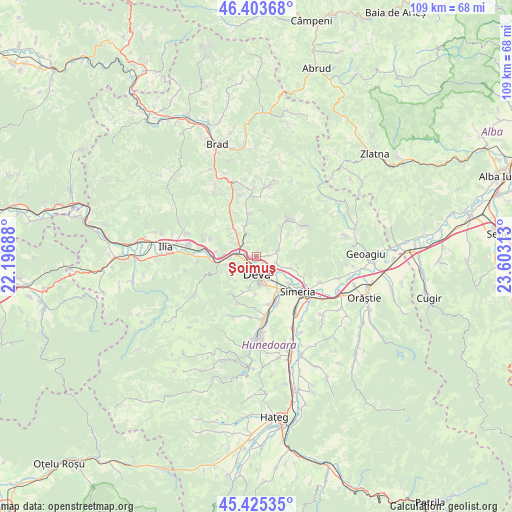
Şoimuş GPS coordinates[2]
45° 55' 0.012" North, 22° 54' 0" East
| Map corner | latitude | longitude |
|---|---|---|
| Upper-left | 46.40368°, | 22.19688° |
| Center: | 45.91667°, | 22.9° |
| Lower-right: | 45.42535°, | 23.60313° |
| Map W x H: | 108.8×108.8 km | = 67.6×67.6mi |
| max Lat: | 48.23793° ⇑46.9% North |
| Şoimuş: | 45.91667° |
| min Lat: | ⇓53.1% South 43.65638° |
| min Long | Şoimuş | max Long |
| 20.31667° | 22.9° | 29.65403° |
| W 14.1%⇐ | ⇒85.9% E |
Elevation
Elevation of Şoimuş is 194 m = 636 ft, and this is 60.9 m = 200 ft below average elevation for this country.
| Max E: |
1278 m = 4193 ft | 53.5% |
| Avg. | 254.9 m = 836 ft | |
| Şoimuş | 194 m = 636 ft | |
Min E: |
-2 m = -7 ft | 46.5% |
See also: Romania elevation on elevation.city.
Geographical zone
Şoimuş is located in North temperate zone (between Tropic of Cancer and the Arctic Circle). Distance of this North polar circle is 2295.7 km =1426.5 mi to North.| Distance of | km | miles | from Şoimuş |
|---|---|---|---|
| North Pole | 4901.6 | 3045.7 | to North |
| Arctic Circle | 2295.7 | 1426.5 | to North |
| Tropic Cancer | 2499.5 | 1553.1 | to South |
| Equator | 5105.5 | 3172.4 | to South |


Nearby cities:
15 places around Şoimuş: (largest is in red/bold)
• Banpotoc
8.9 km =5.5 mi,  104°
104°
• Boz
11.9 km =7.4 mi,  287°
287°
• Brănişca
9 km =5.6 mi,  270°
270°
• Bârsău
5 km =3.1 mi,  72°
72°
• Certeju de Sus
7.6 km =4.7 mi,  42°
42°
• Cristur
10.3 km =6.4 mi,  160°
160°
• Cârjiţi
9 km =5.6 mi,  214°
214°
• Deva
3.7 km =2.3 mi,  180°
180°
• Hondol
10.3 km =6.4 mi, 40°
• Hărău
4.3 km =2.7 mi,  115°
115°
• Mintia
4.1 km =2.5 mi,  280°
280°
• Simeria
11.7 km =7.3 mi,  129°
129°
• Sântandrei
9 km =5.6 mi,  145°
145°
• Sântuhalm
7.8 km =4.8 mi, 147°
• Veţel
6.7 km =4.2 mi,  253°
253°
Sources, notices
• [Note1] Compared only with cities in Romania existing in our database
• [Src1] Map data: © OpenStreetMap contributors (CC-BY-SA)
• [Src2] Other city data from geonames.org with taken over terms of usage.
• [Src3] Geographical zone / Annual Mean Temperature by Robert A. Rohde @ Wikipedia
