Sadova geodata
Sadova (Suceava) is a seat of a second-order administrative division; located in Romania in Europe/Bucharest (GMT+3) time zone. With population of 2,474 people, there are 2185 cities with bigger population in this country. Compared to other cities in Romania, 91.5% of cities are located further ↓South; 54.5% of cities are located further ←West and 98.2% of cities have lower elevation than Sadova. Note1


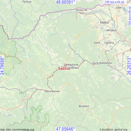
Sadova GPS coordinates[2]
47° 31' 59.988" North, 25° 30' 0" East
| Map corner | latitude | longitude |
|---|---|---|
| Upper-left | 48.00591°, | 24.79688° |
| Center: | 47.53333°, | 25.5° |
| Lower-right: | 47.05646°, | 26.20313° |
| Map W x H: | 105.6×105.6 km | = 65.6×65.6mi |
| max Lat: | 48.23793° ⇑8.5% North |
| Sadova: | 47.53333° |
| min Lat: | ⇓91.5% South 43.65638° |
| min Long | Sadova | max Long |
| 20.31667° | 25.5° | 29.65403° |
| W 54.5%⇐ | ⇒45.5% E |
Elevation
Elevation of Sadova is 788 m = 2585 ft, and this is 533.1 m = 1749 ft above average elevation for this country.
| Max E: |
1278 m = 4193 ft | 1.8% |
| Sadova | 788 m 2585 ft | |
| Avg. | 254.9 m = 836 ft | |
Min E: |
-2 m = -7 ft | 98.2% |
See also: Romania elevation on elevation.city.
Geographical zone
Sadova is located in North temperate zone (between Tropic of Cancer and the Arctic Circle). Distance of this North polar circle is 2116 km =1314.8 mi to North.| Distance of | km | miles | from Sadova |
|---|---|---|---|
| North Pole | 4721.9 | 2934.1 | to North |
| Arctic Circle | 2116 | 1314.8 | to North |
| Tropic Cancer | 2679.3 | 1664.8 | to South |
| Equator | 5285.2 | 3284.1 | to South |


Nearby cities:
15 places around Sadova: (largest is in red/bold)
• Botuș
12.2 km =7.6 mi,  283°
283°
• Breaza
16.4 km =10.2 mi,  303°
303°
• Ciocănești
17.6 km =10.9 mi,  250°
250°
• Colacu
9.6 km =6 mi,  273°
273°
• Câmpulung Moldovenesc
5 km =3.1 mi,  90°
90°
• Deia
11.3 km =7 mi,  52°
52°
• Frumosu
14.6 km =9.1 mi, 50°
• Fundu Moldovei
7.5 km =4.7 mi, 270°
• Moldoviţa
16.9 km =10.5 mi,  8°
8°
• Pojorâta
4.2 km =2.6 mi,  243°
243°
• Prisaca Dornei
11.9 km =7.4 mi, 85°
• Slătioara
14.6 km =9.1 mi,  123°
123°
• Strâmtura
14.6 km =9.1 mi,  68°
68°
• Vama
14.2 km =8.8 mi, 74°
• Vatra Moldoviţei
13.9 km =8.6 mi,  21°
21°
Sources, notices
• [Note1] Compared only with cities in Romania existing in our database
• [Src1] Map data: © OpenStreetMap contributors (CC-BY-SA)
• [Src2] Other city data from geonames.org with taken over terms of usage.
• [Src3] Geographical zone / Annual Mean Temperature by Robert A. Rohde @ Wikipedia
